MyTopo
Ackerman Canyon Nevada US Topo Map
Couldn't load pickup availability
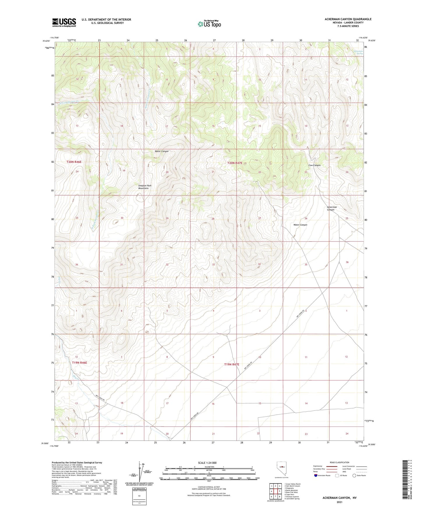
2021 topographic map quadrangle Ackerman Canyon in the state of Nevada. Scale: 1:24000. Based on the newly updated USGS 7.5' US Topo map series, this map is in the following counties: Lander. The map contains contour data, water features, and other items you are used to seeing on USGS maps, but also has updated roads and other features. This is the next generation of topographic maps. Printed on high-quality waterproof paper with UV fade-resistant inks.
Quads adjacent to this one:
West: Bates Mountain
Northwest: Grass Valley Ranch
North: Salt Marsh Canyon
Northeast: Shagnasty
East: Bean Flat West
Southeast: Jackrabbit Spring
South: Hickison Summit
Southwest: Cape Horn
This map covers the same area as the classic USGS quad with code o39116e6.
Contains the following named places: Ackerman Canyon, Ackerman Canyon Ranch, Cow Canyon, Damele Well, Dry Creek Ranch, Dry Creek Ranch Airport, Dry Creek Station, Godber Mine, Water Canyon