MyTopo
Ash Springs Nevada US Topo Map
Couldn't load pickup availability
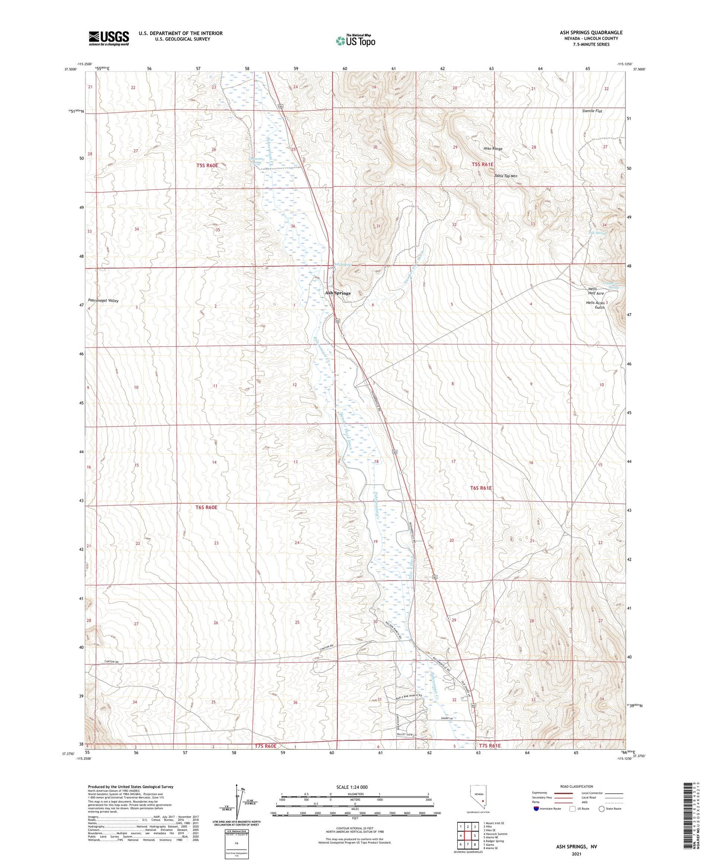
2021 topographic map quadrangle Ash Springs in the state of Nevada. Scale: 1:24000. Based on the newly updated USGS 7.5' US Topo map series, this map is in the following counties: Lincoln. The map contains contour data, water features, and other items you are used to seeing on USGS maps, but also has updated roads and other features. This is the next generation of topographic maps. Printed on high-quality waterproof paper with UV fade-resistant inks.
Quads adjacent to this one:
West: Hancock Summit
Northwest: Mount Irish SE
North: Hiko
Northeast: Hiko SE
East: Alamo NE
Southeast: Alamo SE
South: Alamo
This map covers the same area as the classic USGS quad with code o37115d2.
Contains the following named places: Alamo Census Designated Place, Ash Springs, Brownie Spring, Grapevine Spring, Hells Acres Gulch, Hells Half Acre, Hiko Range, New East Ditch, Number Four Ditch, Number One Ditch, Number Three Ditch, Table Top Mountain, Tule Spring