MyTopo
Alamo Nevada US Topo Map
Couldn't load pickup availability
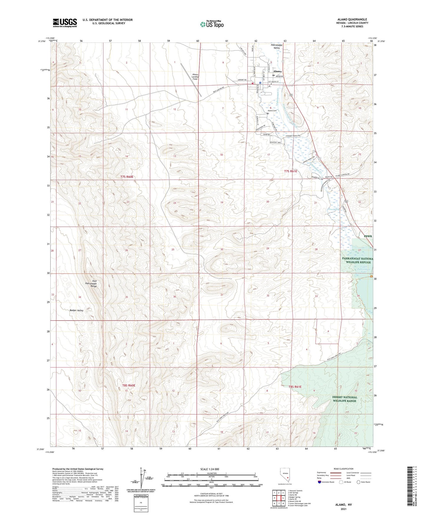
2021 topographic map quadrangle Alamo in the state of Nevada. Scale: 1:24000. Based on the newly updated USGS 7.5' US Topo map series, this map is in the following counties: Lincoln. The map contains contour data, water features, and other items you are used to seeing on USGS maps, but also has updated roads and other features. This is the next generation of topographic maps. Printed on high-quality waterproof paper with UV fade-resistant inks.
Quads adjacent to this one:
Northwest: Hancock Summit
North: Ash Springs
Northeast: Alamo NE
East: Alamo SE
Southeast: Lower Pahranagat Lake
South: Lower Pahranagat Lake NW
This map covers the same area as the classic USGS quad with code o37115c2.
Contains the following named places: Alamo, Alamo Cemetery, Alamo Company Canal, Alamo Company East Ditch, Alamo Landing Field, Alamo Post Office, Alamo School, Buckhorn Ranch, East Pahranagat Range, Grove Spring, Lincoln County Sheriff's Office - Alamo Substation, Pahranagat Creek, Pahranagat Valley Elementary School, Pahranagat Valley High School, Pahranagat Valley Middle School, Pahranagat Valley Volunteer Fire Department, Piersons Ranch, Upper Pahranagat Lake