MyTopo
Basque Summit Nevada US Topo Map
Couldn't load pickup availability
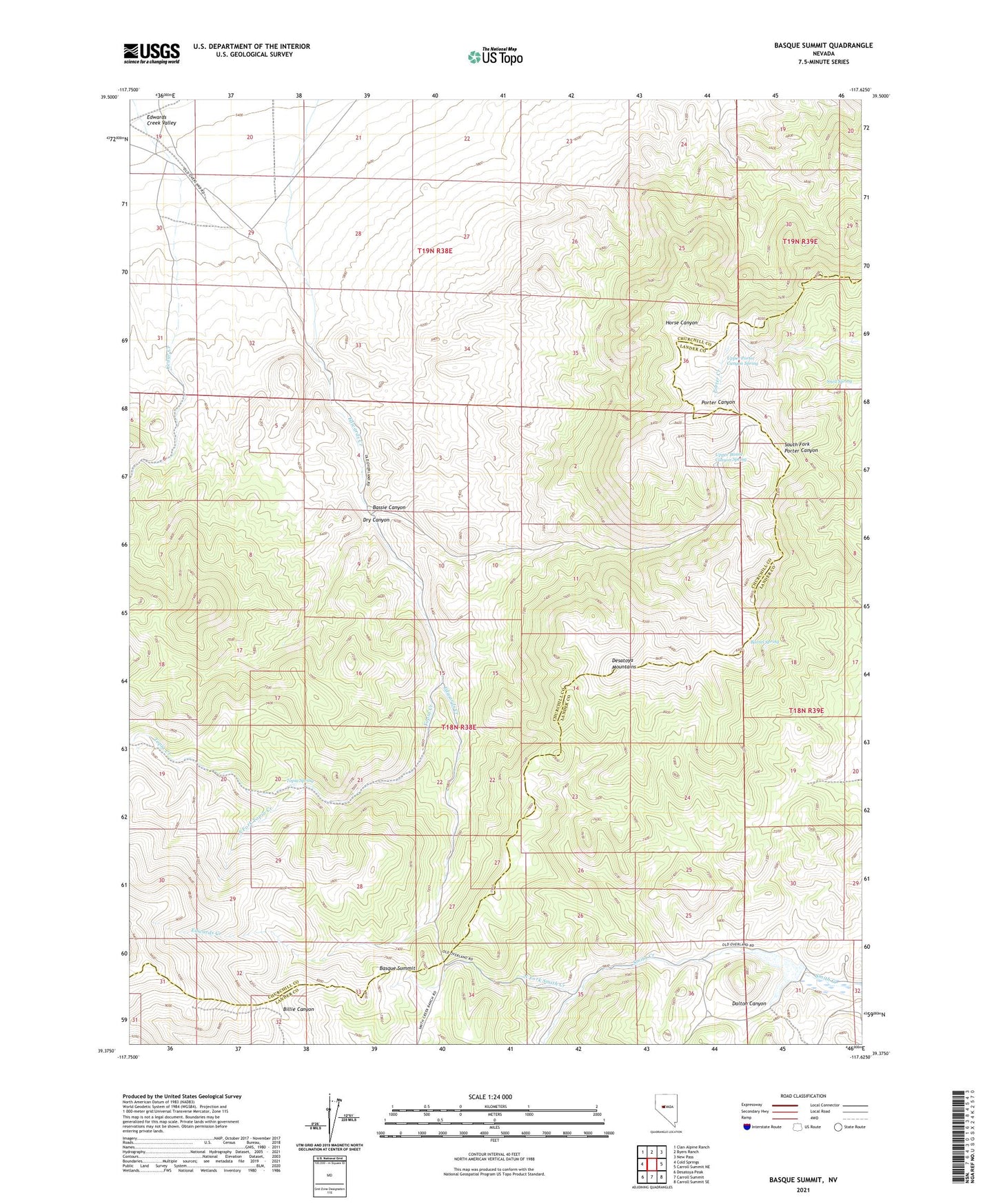
2021 topographic map quadrangle Basque Summit in the state of Nevada. Scale: 1:24000. Based on the newly updated USGS 7.5' US Topo map series, this map is in the following counties: Churchill, Lander. The map contains contour data, water features, and other items you are used to seeing on USGS maps, but also has updated roads and other features. This is the next generation of topographic maps. Printed on high-quality waterproof paper with UV fade-resistant inks.
Quads adjacent to this one:
West: Cold Springs
Northwest: Clan Alpine Ranch
North: Byers Ranch
Northeast: New Pass
East: Carroll Summit NE
Southeast: Carroll Summit SE
South: Carroll Summit
Southwest: Desatoya Peak
This map covers the same area as the classic USGS quad with code o39117d6.
Contains the following named places: Barrel Spring, Basque Summit, Bassie Canyon, Dalton Canyon, Desatoya Mountains, Dry Canyon, Maestretti, Maestretti Post Office, North Fork Smith Creek, Overland Mail Station, Smith Creek Dam, Smith Creek Ranch, Smith Creek Reservoir, Snell Spring, South Fork Topia Creek, Topia Creek, Topia Spring, Upper Bassie Canyon Spring, Upper Porter Canyon Spring