MyTopo
New Pass Nevada US Topo Map
Couldn't load pickup availability
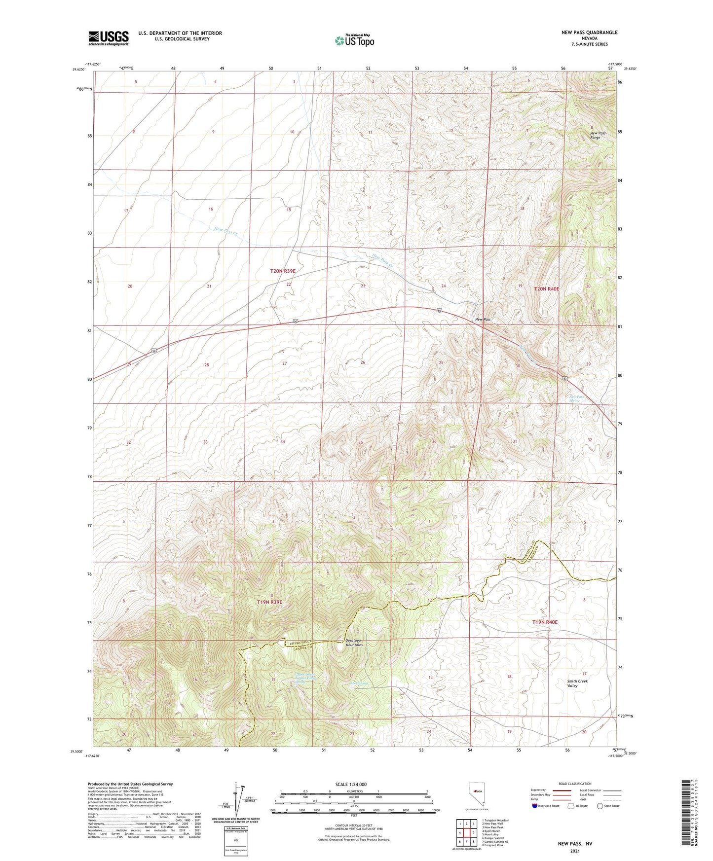
2021 topographic map quadrangle New Pass in the state of Nevada. Scale: 1:24000. Based on the newly updated USGS 7.5' US Topo map series, this map is in the following counties: Churchill, Lander. The map contains contour data, water features, and other items you are used to seeing on USGS maps, but also has updated roads and other features. This is the next generation of topographic maps. Printed on high-quality waterproof paper with UV fade-resistant inks.
Quads adjacent to this one:
West: Byers Ranch
Northwest: Tungsten Mountain
North: New Pass Well
Northeast: New Pass Peak
East: Mount Airy
Southeast: Emigrant Peak
South: Carroll Summit NE
Southwest: Basque Summit
This map covers the same area as the classic USGS quad with code o39117e5.
Contains the following named places: Abel Spring, New Pass, New Pass Mining District, New Pass Spring, Overland Stage Station, Upper Lower Jordan Valley Spring