MyTopo
Bell Canyon Nevada US Topo Map
Couldn't load pickup availability
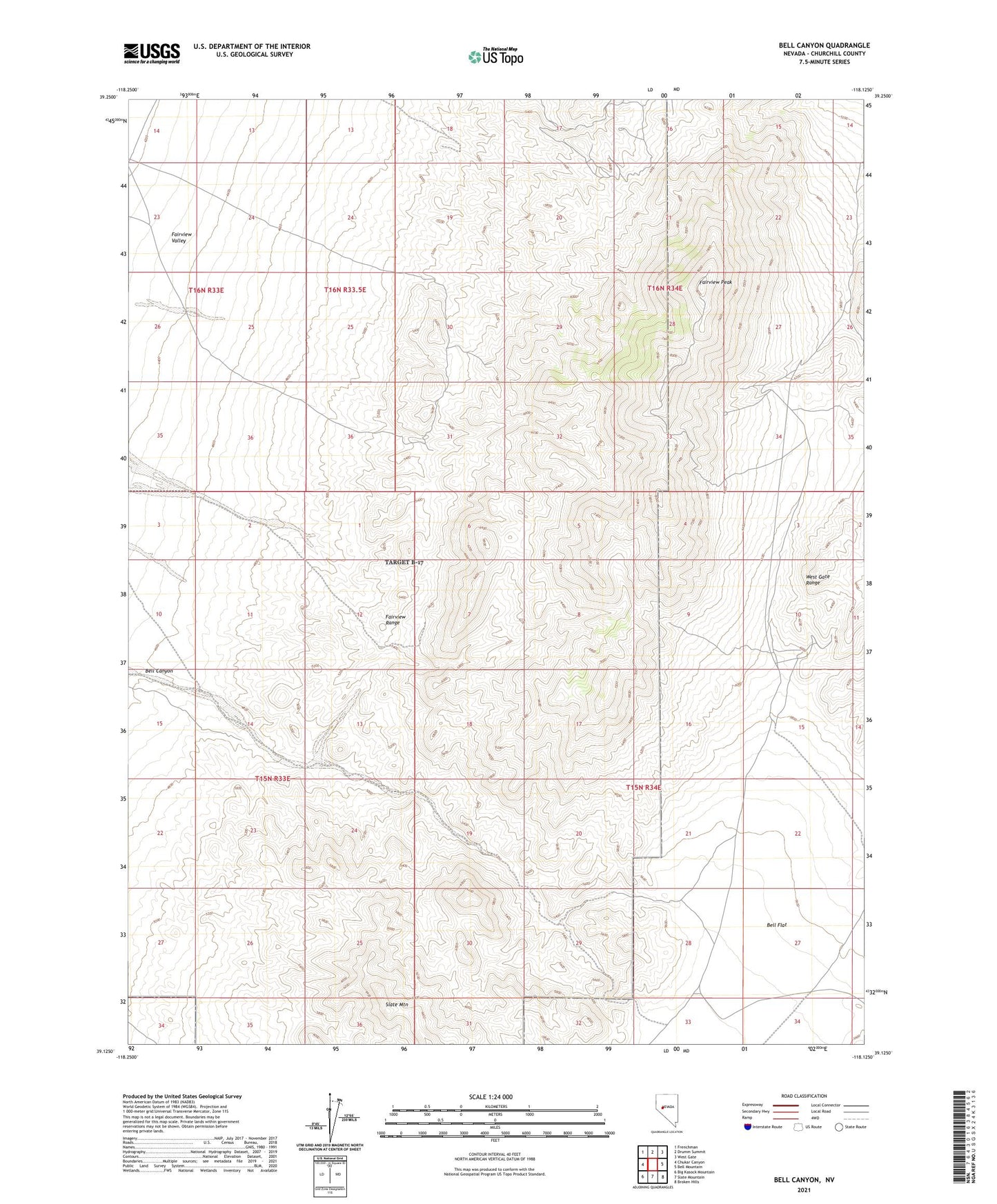
2021 topographic map quadrangle Bell Canyon in the state of Nevada. Scale: 1:24000. Based on the newly updated USGS 7.5' US Topo map series, this map is in the following counties: Churchill. The map contains contour data, water features, and other items you are used to seeing on USGS maps, but also has updated roads and other features. This is the next generation of topographic maps. Printed on high-quality waterproof paper with UV fade-resistant inks.
Quads adjacent to this one:
West: Chukar Canyon
Northwest: Frenchman
North: Drumm Summit
Northeast: West Gate
East: Bell Mountain
Southeast: Broken Hills
South: Slate Mountain
Southwest: Big Kasock Mountain
This map covers the same area as the classic USGS quad with code o39118b2.
Contains the following named places: Bell Canyon, Bell Flat Well, Bell Mountain Mine, Bluff Mine, Canyon, Fairview Mining District, Fairview Peak, Fairview Range, Gold Coin Mine, Gold Coin Number Two Mine, Mizpah Mine, Nevada Crown Mine, Nevada Fairview Mine, Nevada Hills, Nevada Hills Mill, Nevada Hills Mine, Nevadahills Post Office, Togo