MyTopo
Bellehelen Nevada US Topo Map
Couldn't load pickup availability
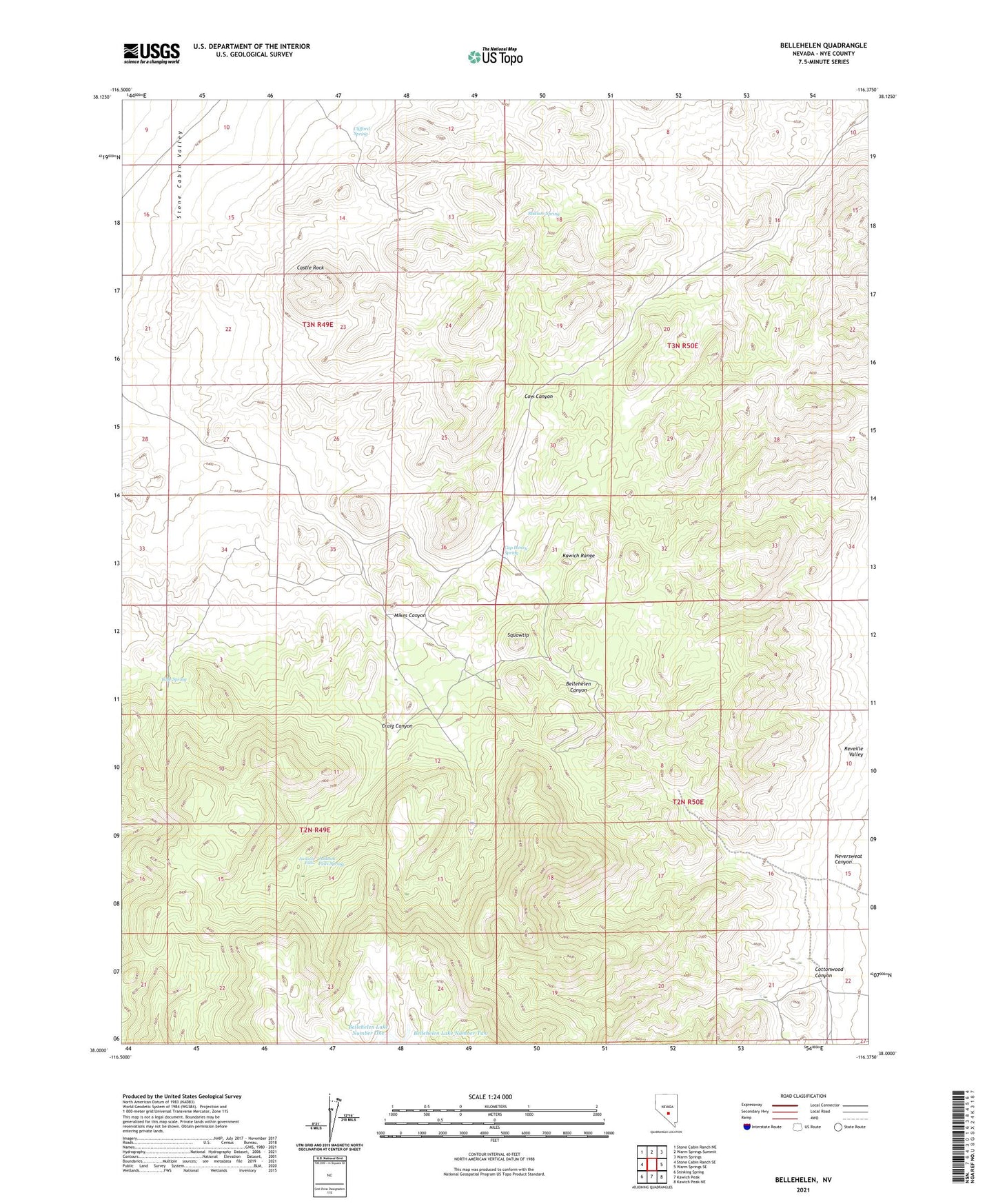
2023 topographic map quadrangle Bellehelen in the state of Nevada. Scale: 1:24000. Based on the newly updated USGS 7.5' US Topo map series, this map is in the following counties: Nye. The map contains contour data, water features, and other items you are used to seeing on USGS maps, but also has updated roads and other features. This is the next generation of topographic maps. Printed on high-quality waterproof paper with UV fade-resistant inks.
Quads adjacent to this one:
West: Stone Cabin Ranch SE
Northwest: Stone Cabin Ranch NE
North: Warm Springs Summit
Northeast: Warm Springs
East: Warm Springs SE
This map covers the same area as the classic USGS quad with code o38116a4.
Contains the following named places: Ajax Mine, Bellehelen, Bellehelen Lake Number One, Bellehelen Lake Number Two, Bellehelen Mining District, Bellehelen Post Office, Bellehelen Ranch, Ben Hur Mine, Ben Hur Ranch, Cap Henry Spring, Castle Rock, Cedar Mine, Clifford Spring, Cottonwood Canyon, Craig Canyon, Craig Mine, Jackson Falls, Jackson Falls Spring, Lower Belie Helen Gulch Well Number One, Lower Belie Helen Gulch Well Number Two, Merger Mine, Mikes Canyon, Neversweat Canyon, Nye County, Peterson Mine, Radium Spring, South Star Mine, Squawtip, Tobe Spring