MyTopo
Bellevue Peak Nevada US Topo Map
Couldn't load pickup availability
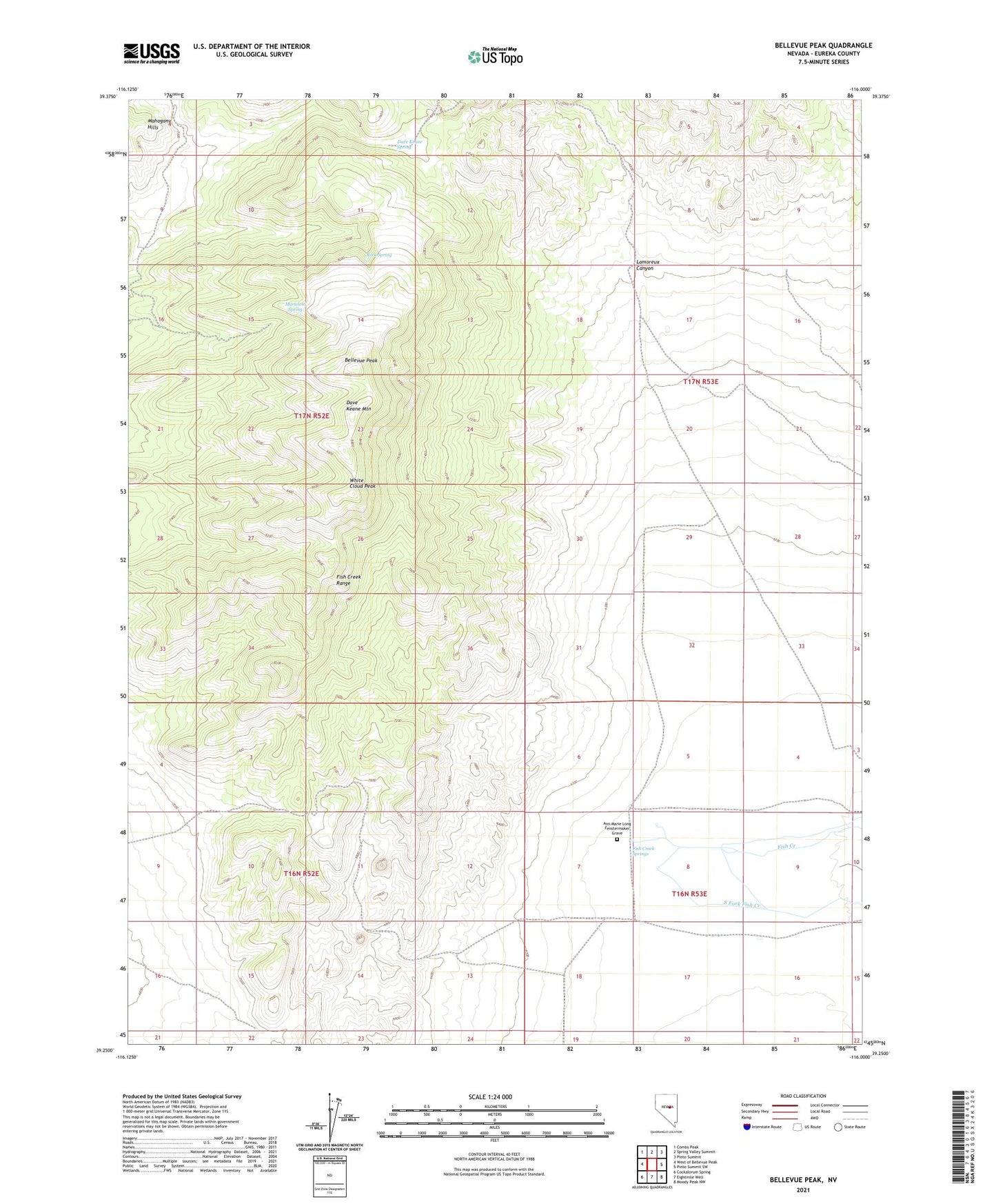
2021 topographic map quadrangle Bellevue Peak in the state of Nevada. Scale: 1:24000. Based on the newly updated USGS 7.5' US Topo map series, this map is in the following counties: Eureka. The map contains contour data, water features, and other items you are used to seeing on USGS maps, but also has updated roads and other features. This is the next generation of topographic maps. Printed on high-quality waterproof paper with UV fade-resistant inks.
Quads adjacent to this one:
West: West of Bellevue Peak
Northwest: Combs Peak
North: Spring Valley Summit
Northeast: Pinto Summit
East: Pinto Summit SW
Southeast: Moody Peak NW
South: Eightmile Well
Southwest: Cockalorum Spring
Contains the following named places: Ann Marie Long Fenstermaker Grave, Bellevue Peak, Dave Keane Mountain, Dave Keane Spring, Fish Creek Mining District, Fish Creek Range, Fish Creek Springs, Lamoreux Canyon, Marteletti Spring, Rock Spring, White Cloud Peak