MyTopo
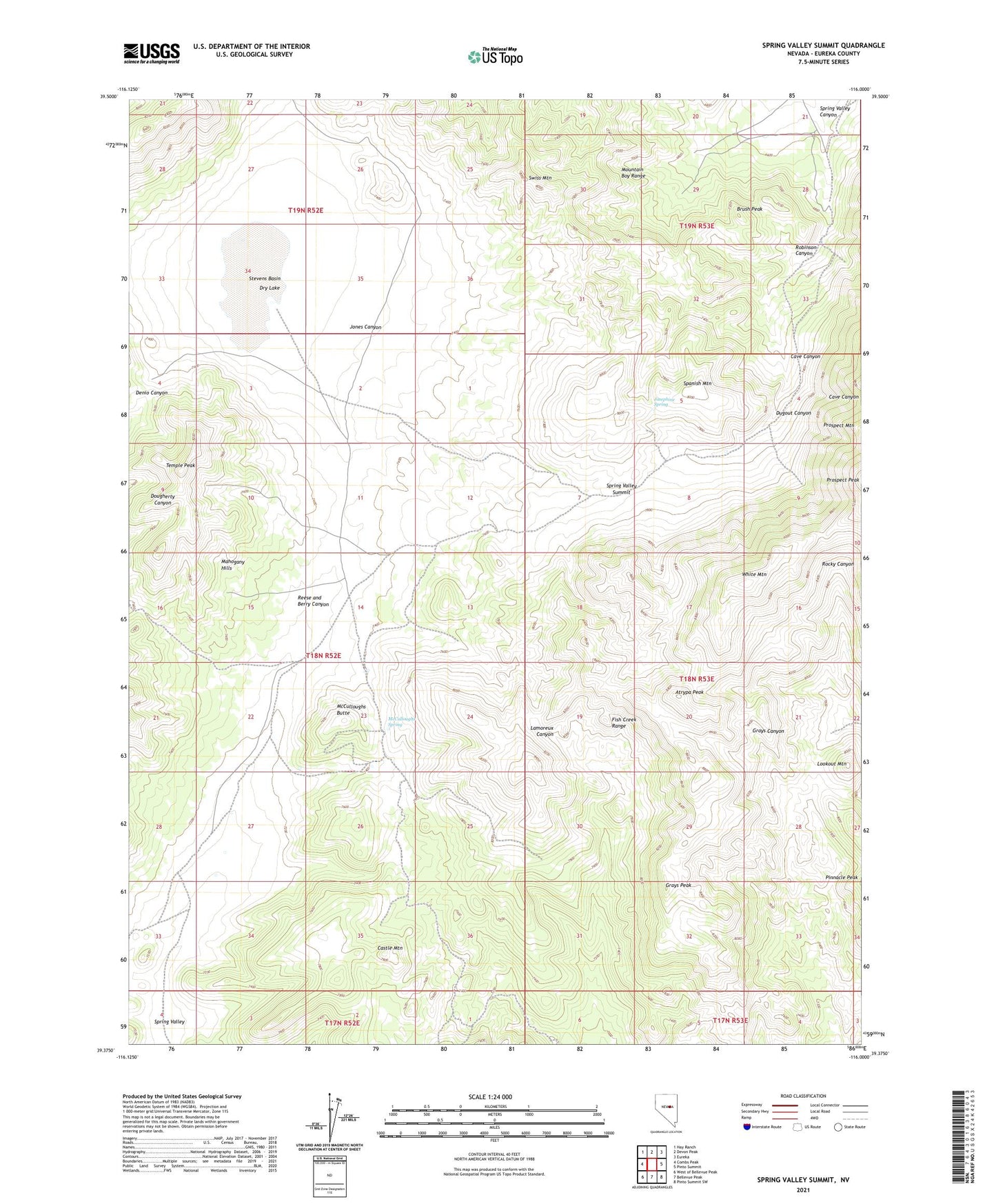
Spring Valley Summit Nevada US Topo Map
Couldn't load pickup availability
2021 topographic map quadrangle Spring Valley Summit in the state of Nevada. Scale: 1:24000. Based on the newly updated USGS 7.5' US Topo map series, this map is in the following counties: Eureka. The map contains contour data, water features, and other items you are used to seeing on USGS maps, but also has updated roads and other features. This is the next generation of topographic maps. Printed on high-quality waterproof paper with UV fade-resistant inks.
Quads adjacent to this one:
West: Combs Peak
Northwest: Hay Ranch
North: Devon Peak
Northeast: Eureka
East: Pinto Summit
Southeast: Pinto Summit SW
South: Bellevue Peak
Southwest: West of Bellevue Peak
This map covers the same area as the classic USGS quad with code o39116d1.
Contains the following named places: Atrypa Peak, Brush Peak, Castle Mountain, Cave Canyon, Dry Lake, Dry Lake Well, Dugout Canyon, Dugout Tunnels, Grays Peak, Jones Canyon, Josephine Spring, Kentucky Mine, Lookout Mountain, McCulloughs Butte, McCulloughs Spring, Mountain Boy Mine, Mountain Boy Range, Prospect, Prospect Mountain Tunnel, Prospect Post Office, Reese and Berry Canyon, Reese and Berry Mine, Robinson Canyon, Rose Mine, Silver Conner Mine, Spanish Mountain, Spring Valley, Spring Valley Canyon, Spring Valley Summit, Stevens Basin, Swiss Mountain, Temple Peak, White Mountain