
MyTopo
Belmont East Nevada US Topo Map
Couldn't load pickup availability
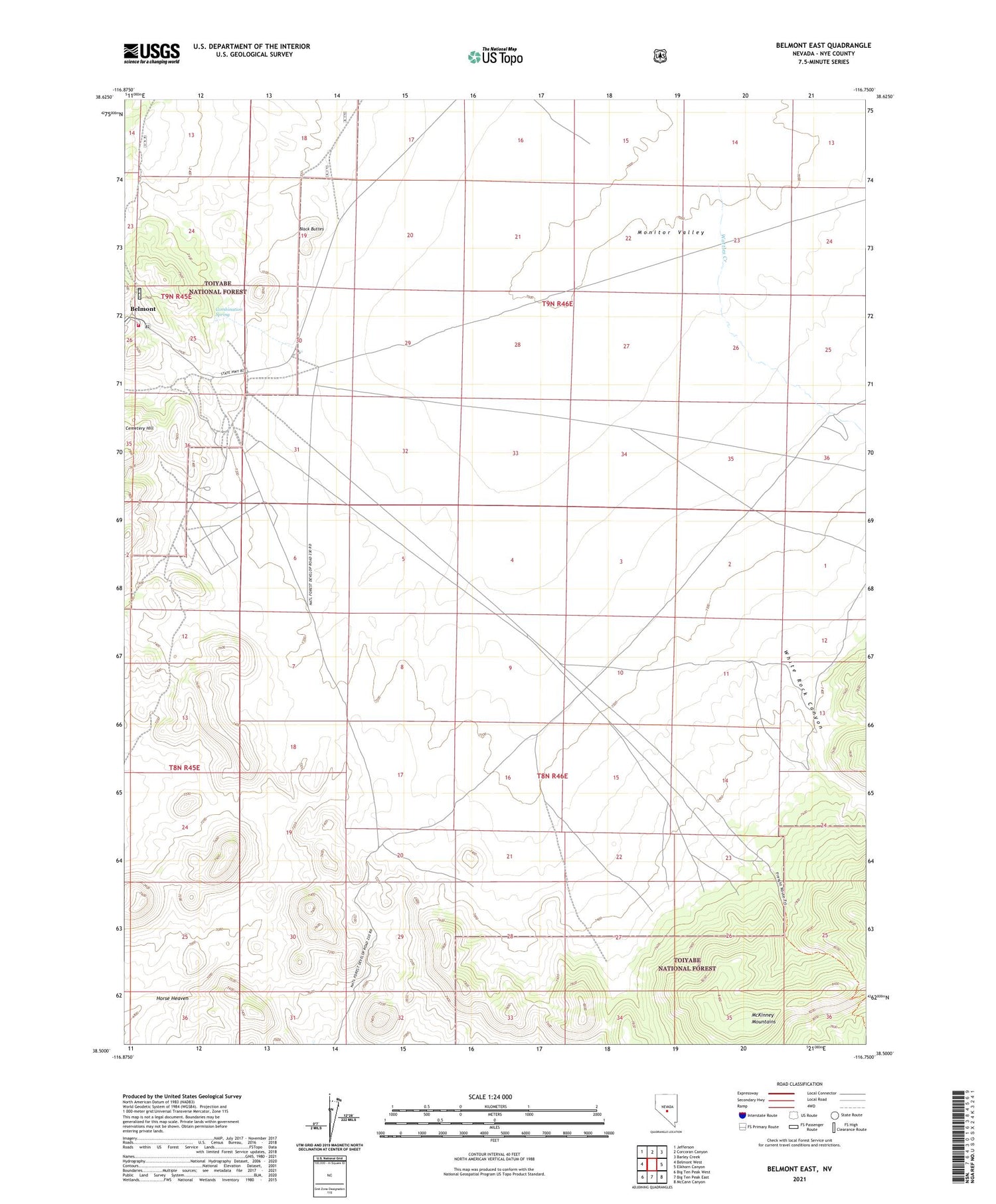
2021 topographic map quadrangle Belmont East in the state of Nevada. Scale: 1:24000. Based on the newly updated USGS 7.5' US Topo map series, this map is in the following counties: Nye. The map contains contour data, water features, and other items you are used to seeing on USGS maps, but also has updated roads and other features. This is the next generation of topographic maps. Printed on high-quality waterproof paper with UV fade-resistant inks.
Quads adjacent to this one:
West: Belmont West
Northwest: Jefferson
North: Corcoran Canyon
Northeast: Barley Creek
East: Elkhorn Canyon
Southeast: McCann Canyon
South: Big Ten Peak East
Southwest: Big Ten Peak West
Contains the following named places: Arizona Mine, Belmont, Belmont Big Four Mine, Belmont Fire Department, Belmont Mining District, Belmont Post Office, Belmont Shaft, Black Buttes, Canfield Mine, Cemetery Hill, Combination Mill, Combination Spring, East Belmont, El Dorado North Mine, El Dorado South Mine, Eldorado Mill, Highbridge Mill, Highbridge Shaft, Horse Heaven, Monitor Belmont Mine, Wattles Creek, White Rock Canyon


