MyTopo
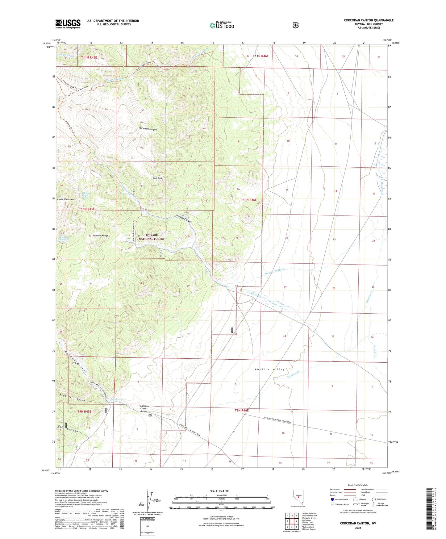
Corcoran Canyon Nevada US Topo Map
Couldn't load pickup availability
Also explore the Corcoran Canyon Forest Service Topo of this same quad for updated USFS data
2021 topographic map quadrangle Corcoran Canyon in the state of Nevada. Scale: 1:24000. Based on the newly updated USGS 7.5' US Topo map series, this map is in the following counties: Nye. The map contains contour data, water features, and other items you are used to seeing on USGS maps, but also has updated roads and other features. This is the next generation of topographic maps. Printed on high-quality waterproof paper with UV fade-resistant inks.
Quads adjacent to this one:
West: Jefferson
Northwest: Mount Jefferson
North: Pine Creek Ranch
Northeast: Mosquito Creek
East: Barley Creek
Southeast: Elkhorn Canyon
South: Belmont East
Southwest: Belmont West
This map covers the same area as the classic USGS quad with code o38116f7.
Contains the following named places: Barley Creek, Corcoran Canyon, Corcoran Creek, Corcoran Divide Spring, Ellsworth Ophir Barley Creek Freight Route, Haystack Ranch, Little Table Mountain, Little Table Mountain Spring, Meadow Canyon, Meadow Creek Bench, Meadow Creek Ranch, Ryecroft Canyon, Stone House, Stone House Ranch, Toll Canyon, Tooth Rock, Trail Canyon, Waterfall Canyon, Widow Smiths Creek