MyTopo
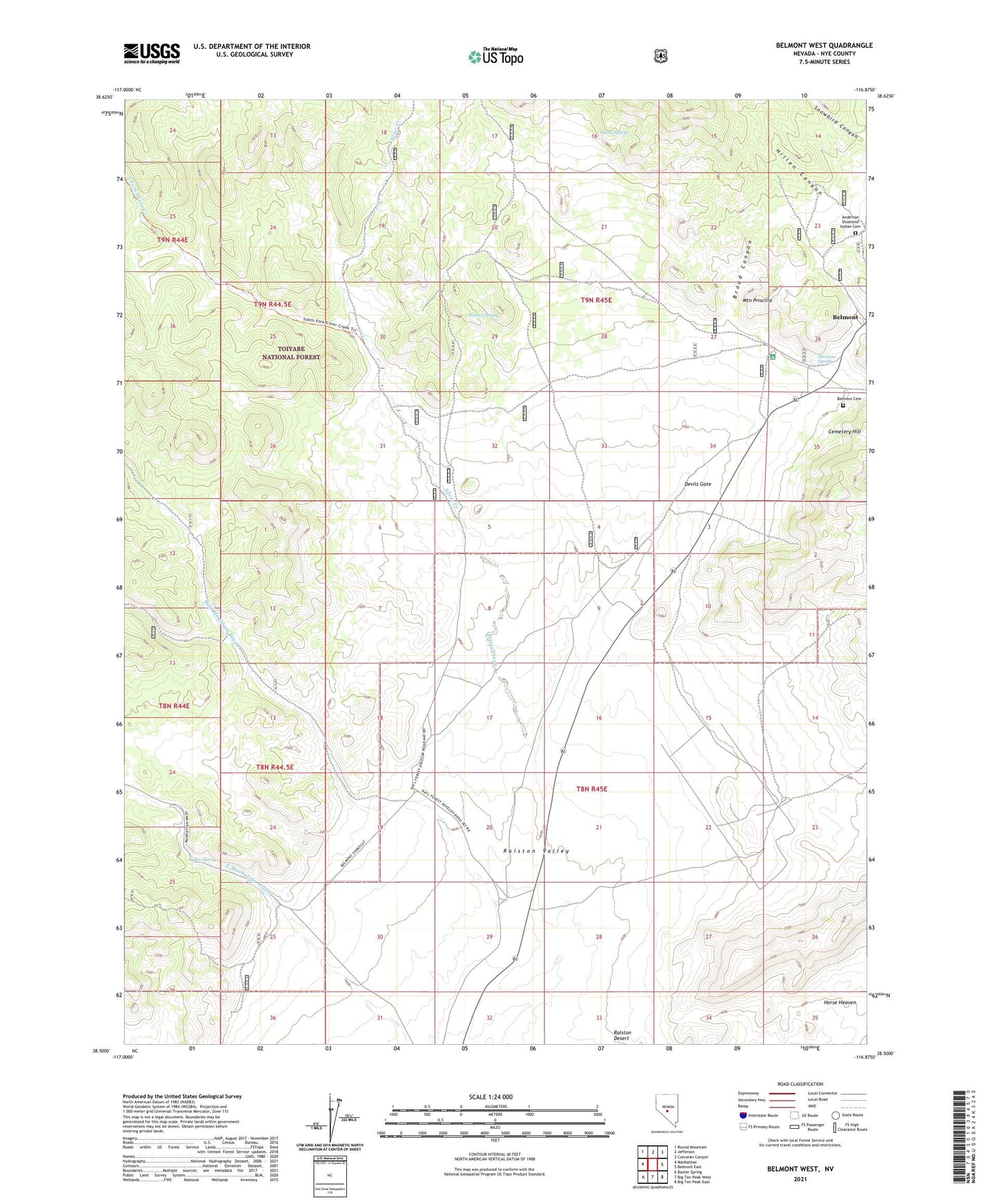
Belmont West Nevada US Topo Map
Couldn't load pickup availability
Also explore the Belmont West Forest Service Topo of this same quad for updated USFS data
2021 topographic map quadrangle Belmont West in the state of Nevada. Scale: 1:24000. Based on the newly updated USGS 7.5' US Topo map series, this map is in the following counties: Nye. The map contains contour data, water features, and other items you are used to seeing on USGS maps, but also has updated roads and other features. This is the next generation of topographic maps. Printed on high-quality waterproof paper with UV fade-resistant inks.
Quads adjacent to this one:
West: Manhattan
Northwest: Round Mountain
North: Jefferson
Northeast: Corcoran Canyon
East: Belmont East
Southeast: Big Ten Peak East
South: Big Ten Peak West
Southwest: Baxter Spring
This map covers the same area as the classic USGS quad with code o38116e8.
Contains the following named places: Anderson Shoshone Indian Cemetery, Bald Mountain Wash, Belmont Cemetery, Belmont Courthouse State Historic Site, Broad Canyon, Devils Gate, Hillen Canyon, Hunter Spring, Hunts Spring, Keller Spring, Mexican Spring, Monarch, Monarch Post Office, Monitor Mill, Mountain Priscilla, Old Courthouse, Silver Creek, Snowbird Canyon, South Fork Silver Creek, Zabriskie Well