MyTopo
Bettles Well Nevada US Topo Map
Couldn't load pickup availability
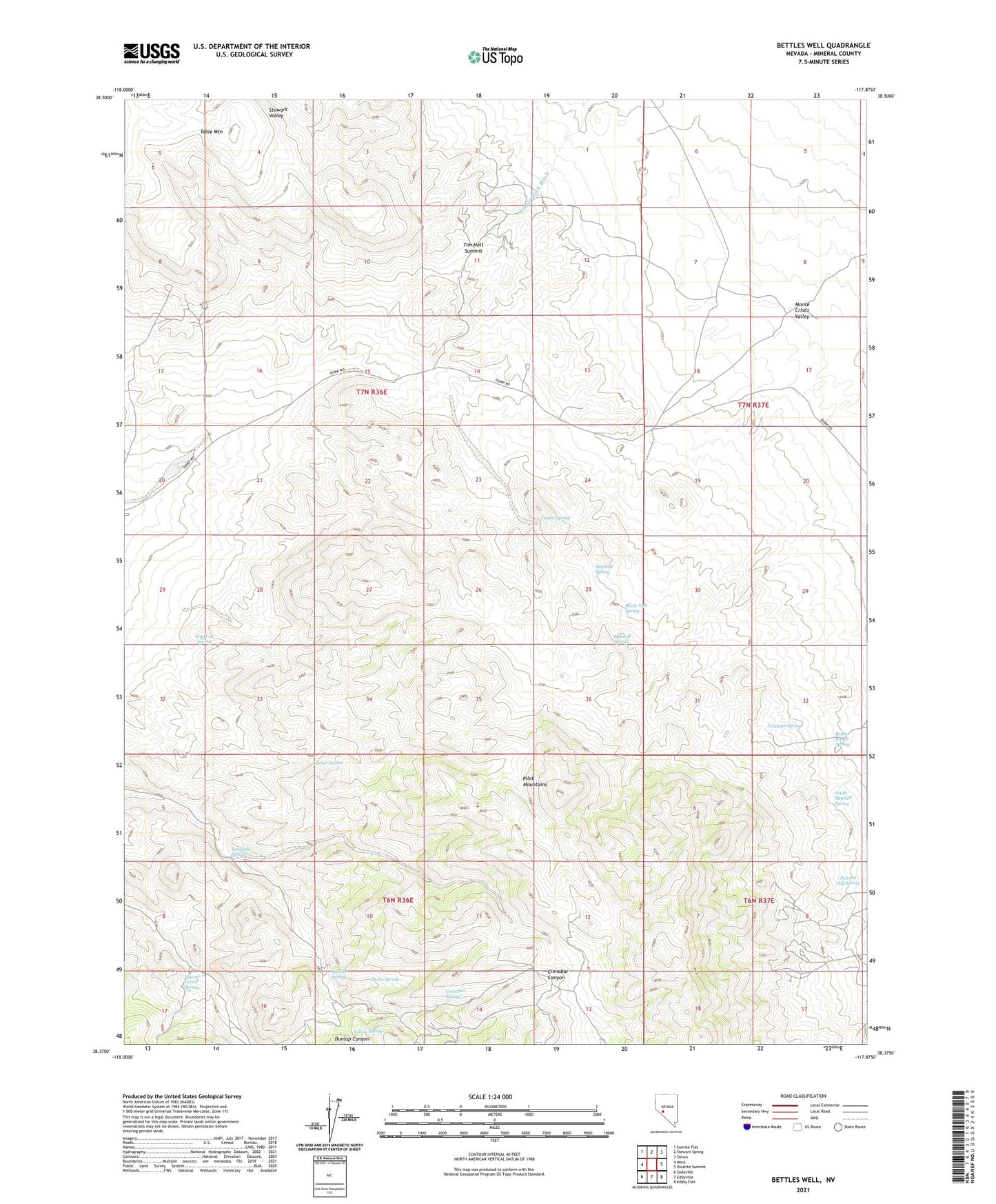
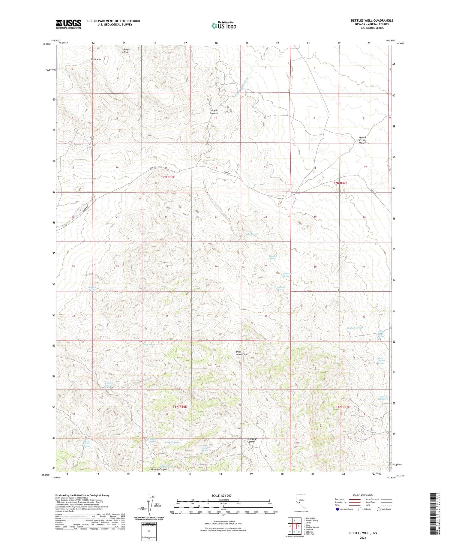
2021 topographic map quadrangle Bettles Well in the state of Nevada. Scale: 1:24000. Based on the newly updated USGS 7.5' US Topo map series, this map is in the following counties: Mineral. The map contains contour data, water features, and other items you are used to seeing on USGS maps, but also has updated roads and other features. This is the next generation of topographic maps. Printed on high-quality waterproof paper with UV fade-resistant inks.
Quads adjacent to this one:
West: Mina
Northwest: Sunrise Flat
North: Stewart Spring
Northeast: Simon
East: Dicalite Summit
Southeast: Kibby Flat
South: Eddyville
Southwest: Sodaville
Contains the following named places: Bettles Mine, Bettles Ranch Spring, Bettles Well, Black Jack Spring, Cedar Mountain Well, Cinnabar Spring, Clay Peters Mine, Copper Chief Mine, Corner Spring, Coveney Mine, Davis Spring, Drew Mine, Garnet Mine, Graham Spring, Gunmetal Mine, Keg Mine, Klondike, Kope Scheelite Mine, Lakeview Mine, Lindsey Mine, Mammoth Mine, Millsite Spring, Mitchell Spring, Pilot Mountains Mining District, Point of Hill Spring, Redwing Mine, Roadside Spring, South Mitchell Spring, Sullivans Camp, Table Mountain, Taylor Spring, Tim Holt Summit, Warner Corral Spring, Wild Cat Spring, Yellow Spring