MyTopo
Sodaville Nevada US Topo Map
Couldn't load pickup availability
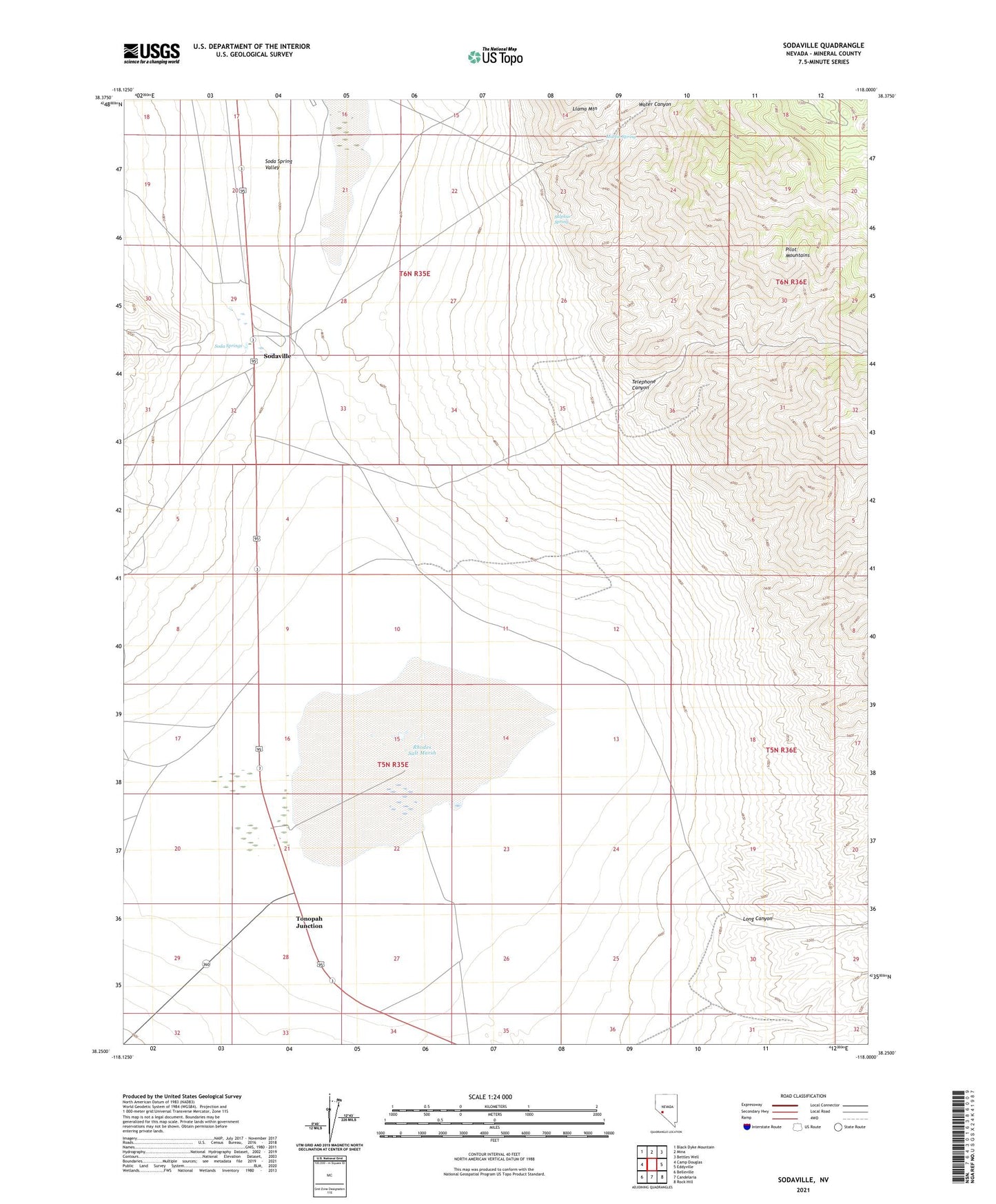
2021 topographic map quadrangle Sodaville in the state of Nevada. Scale: 1:24000. Based on the newly updated USGS 7.5' US Topo map series, this map is in the following counties: Mineral. The map contains contour data, water features, and other items you are used to seeing on USGS maps, but also has updated roads and other features. This is the next generation of topographic maps. Printed on high-quality waterproof paper with UV fade-resistant inks.
Quads adjacent to this one:
West: Camp Douglas
Northwest: Black Dyke Mountain
North: Mina
Northeast: Bettles Well
East: Eddyville
Southeast: Rock Hill
South: Candelaria
Southwest: Belleville
This map covers the same area as the classic USGS quad with code o38118c1.
Contains the following named places: American Mining Corporation, Arthur Salt and Borax Placer Mine, Black Jack Mine, Dea Post Office, Garfield Salt and Borax Placer Mine, Long Canyon, Martin Spring, Mount Diablo Reduction Works, Rhodes, Rhodes Marsh Mining District, Rhodes Marsh Station, Rhodes Salt Marsh, Soda Springs, Sodaville, Sodaville Post Office, Sulphur Spring, Telephone Canyon, Tonopah Junction, Water Canyon