MyTopo
Sunrise Flat Nevada US Topo Map
Couldn't load pickup availability
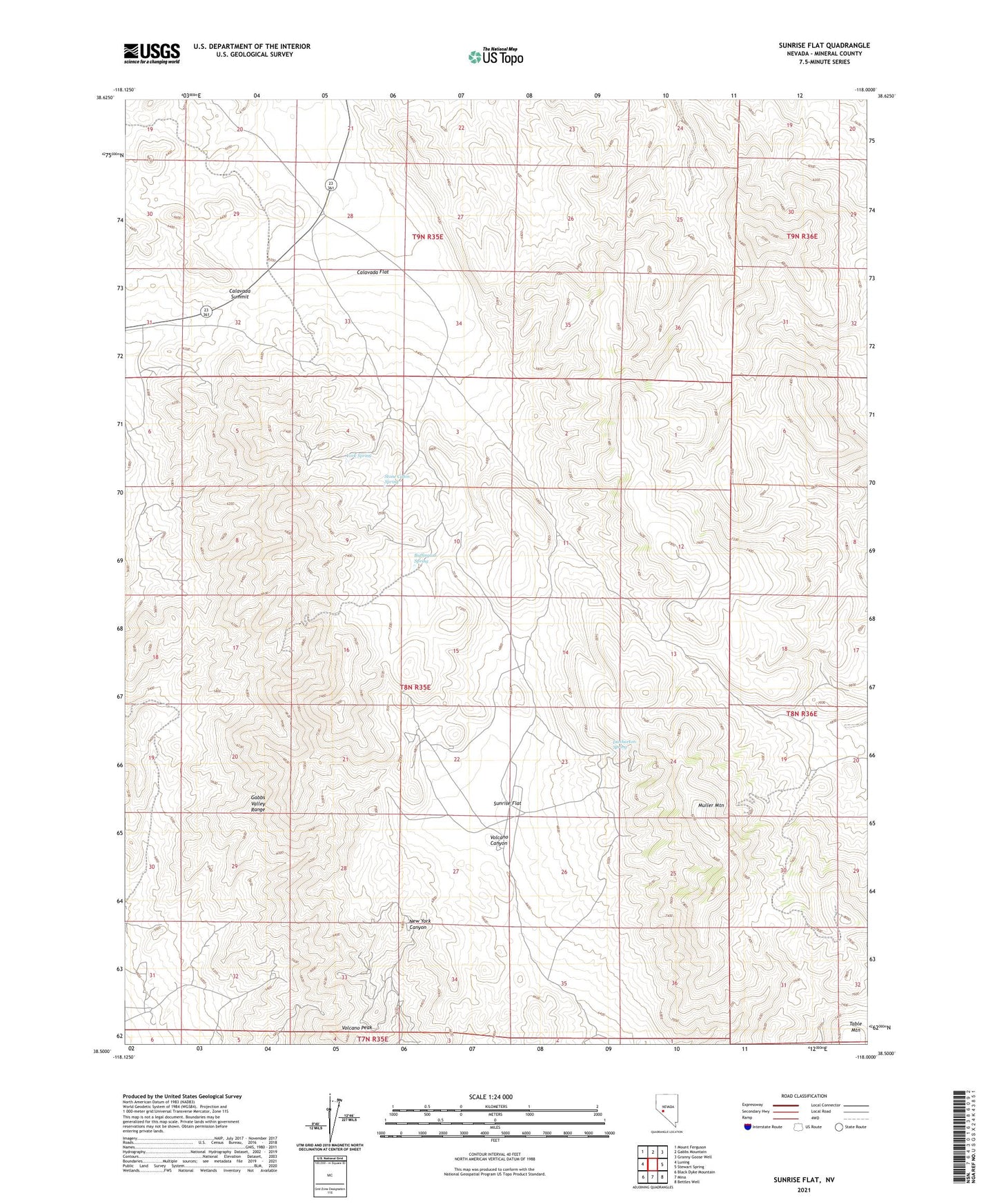
2021 topographic map quadrangle Sunrise Flat in the state of Nevada. Scale: 1:24000. Based on the newly updated USGS 7.5' US Topo map series, this map is in the following counties: Mineral. The map contains contour data, water features, and other items you are used to seeing on USGS maps, but also has updated roads and other features. This is the next generation of topographic maps. Printed on high-quality waterproof paper with UV fade-resistant inks.
Quads adjacent to this one:
West: Luning
Northwest: Mount Ferguson
North: Gabbs Mountain
Northeast: Granny Goose Well
East: Stewart Spring
Southeast: Bettles Well
South: Mina
Southwest: Black Dyke Mountain
This map covers the same area as the classic USGS quad with code o38118e1.
Contains the following named places: Buffington Spring, Calavada Flat, Calavada Summit, Champion Anderson Mine, Copper Head Mine, Copper Queen Mine, Dunbarton Spring, Eagle Mine, Emma Mine, Giroux Mine, Ideal Mine, Iron Butte Mine, Iron Gate Mine, Jasper Mine, Mayflower Mine, Muller Mountain, Santa Fe Mining District, Stone Cabin Spring, Sunrise Flat, Volcano Peak, Wallstreet and Turk Mines, Wedge Copper Mine, Western Metals Mine, York Mine, York Spring