
MyTopo
Big Bald Mountain Nevada US Topo Map
Couldn't load pickup availability
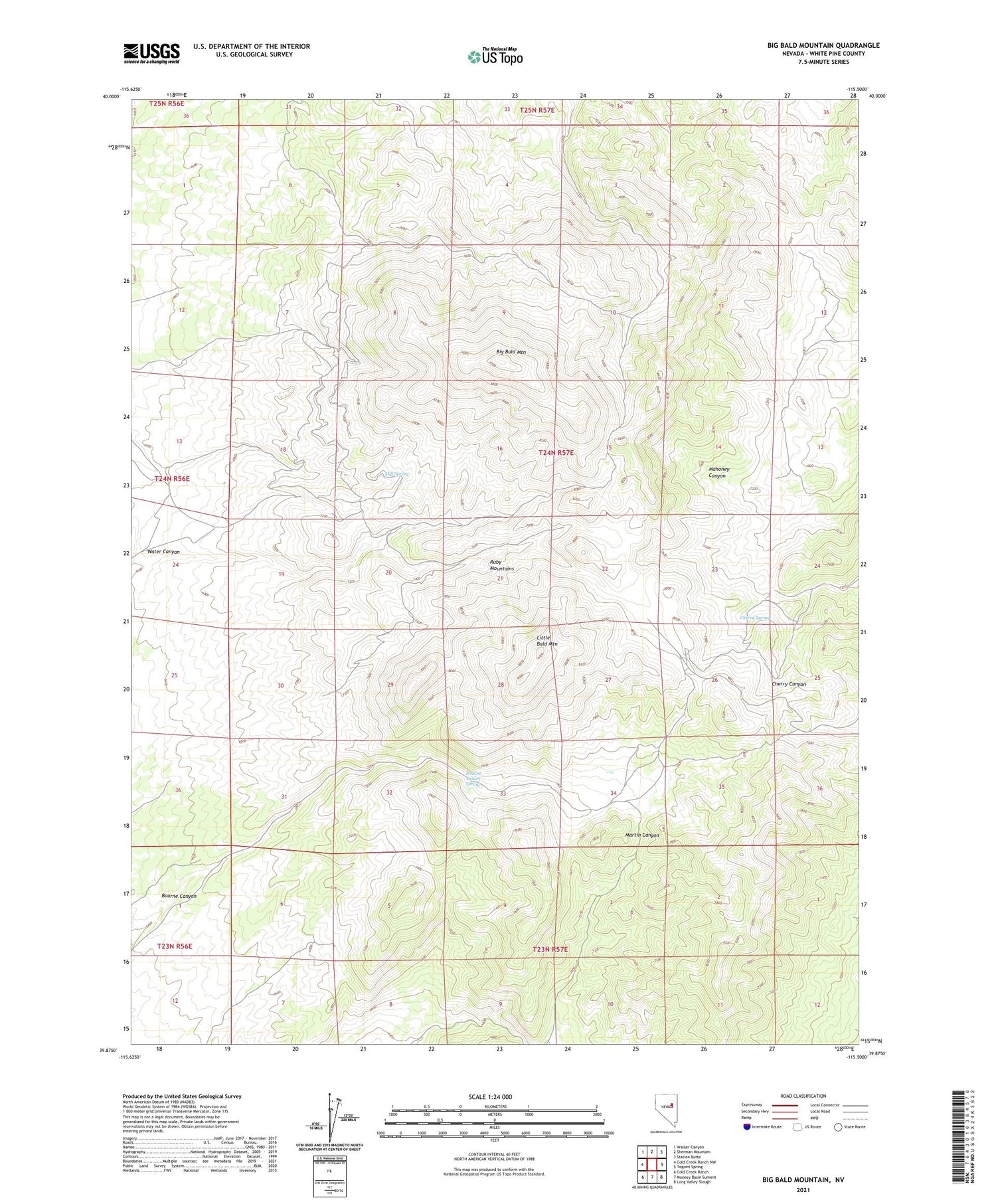
2021 topographic map quadrangle Big Bald Mountain in the state of Nevada. Scale: 1:24000. Based on the newly updated USGS 7.5' US Topo map series, this map is in the following counties: White Pine. The map contains contour data, water features, and other items you are used to seeing on USGS maps, but also has updated roads and other features. This is the next generation of topographic maps. Printed on high-quality waterproof paper with UV fade-resistant inks.
Quads adjacent to this one:
West: Cold Creek Ranch NW
Northwest: Walker Canyon
North: Sherman Mountain
Northeast: Station Butte
East: Tognini Spring
Southeast: Long Valley Slough
South: Mooney Basin Summit
Southwest: Cold Creek Ranch
Contains the following named places: Bald Mountain Mining District, Big Bald Mountain, Bourne Canyon, Bourne Tunnel Spring, Carbonate Mine, Cherry Canyon, Cherry Spring, Copper Basin Mine, Crown Point Mine, Dees Antimony Mine, Dees Tungsten Mine, Gold King Mine, Joy, Joy Post Office, Little Bald Mountain, Mill Spring, Nevada Mine, Oddie Tunnel, Water Canyon, Water Canyon Placer Mine


