MyTopo
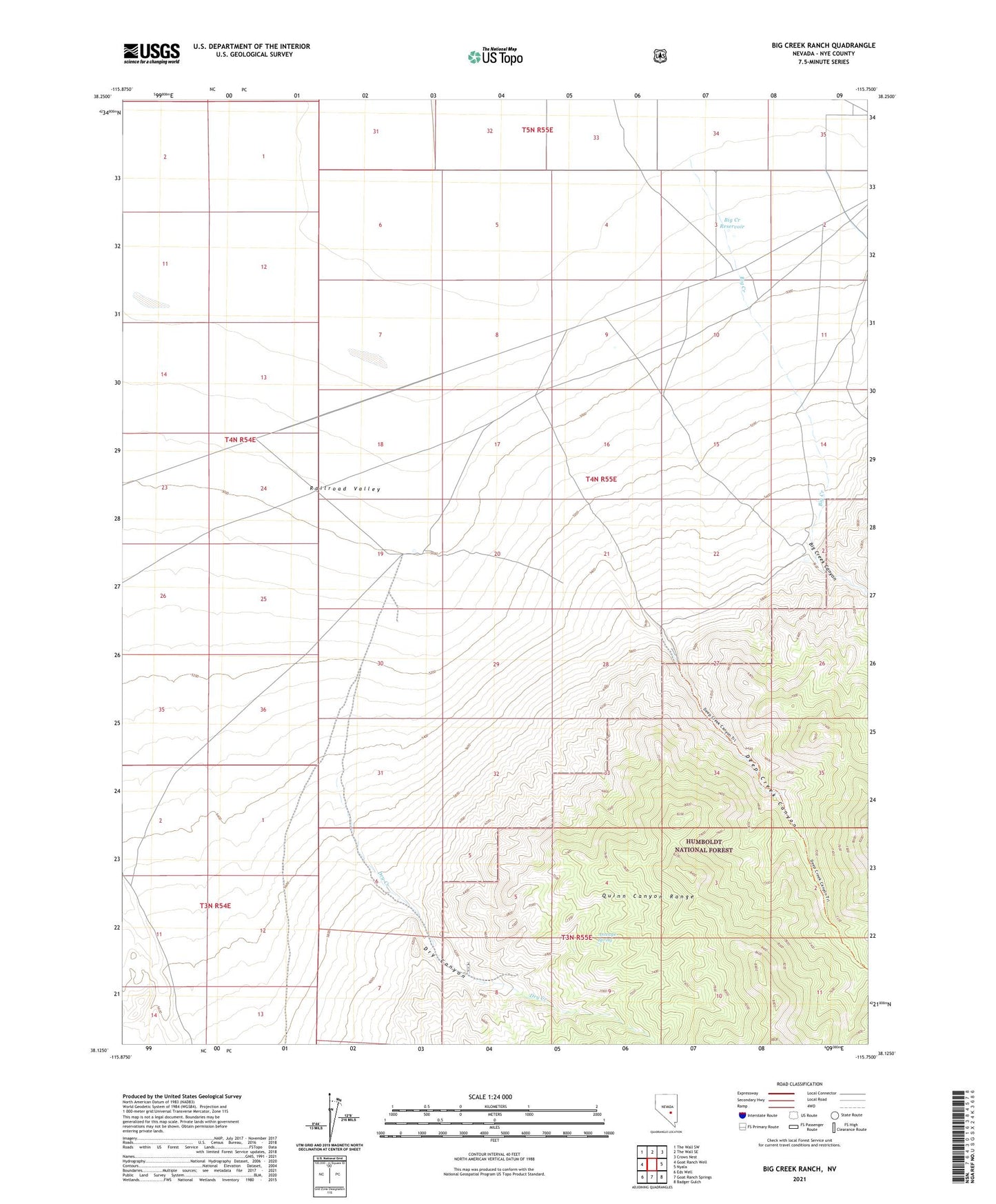
Big Creek Ranch Nevada US Topo Map
Couldn't load pickup availability
Also explore the Big Creek Ranch Forest Service Topo of this same quad for updated USFS data
2021 topographic map quadrangle Big Creek Ranch in the state of Nevada. Scale: 1:24000. Based on the newly updated USGS 7.5' US Topo map series, this map is in the following counties: Nye. The map contains contour data, water features, and other items you are used to seeing on USGS maps, but also has updated roads and other features. This is the next generation of topographic maps. Printed on high-quality waterproof paper with UV fade-resistant inks.
Quads adjacent to this one:
West: Goat Ranch Well
Northwest: The Wall SW
North: The Wall SE
Northeast: Crows Nest
East: Nyala
Southeast: Badger Gulch
South: Goat Ranch Springs
Southwest: Eds Well
This map covers the same area as the classic USGS quad with code o38115b7.
Contains the following named places: Antelope Spring, Big Creek, Big Creek Canyon, Big Creek Ranch, Big Creek Reservoir, Deep Creek Canyon, Dry Canyon, Dry Creek, United Cattle Ranch