MyTopo
Big Ten Peak West Nevada US Topo Map
Couldn't load pickup availability
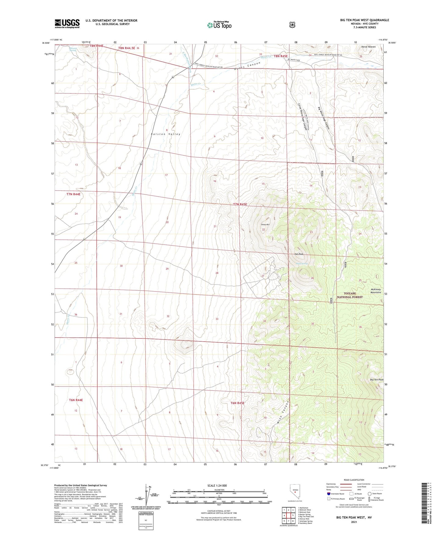
2021 topographic map quadrangle Big Ten Peak West in the state of Nevada. Scale: 1:24000. Based on the newly updated USGS 7.5' US Topo map series, this map is in the following counties: Nye. The map contains contour data, water features, and other items you are used to seeing on USGS maps, but also has updated roads and other features. This is the next generation of topographic maps. Printed on high-quality waterproof paper with UV fade-resistant inks.
Quads adjacent to this one:
West: Baxter Spring
Northwest: Manhattan
North: Belmont West
Northeast: Belmont East
East: Big Ten Peak East
Southeast: Saulsbury Basin
South: Antelope Spring
Southwest: Henrys Well
Contains the following named places: Big 10 Well, Big Ten Peak, Big White Sage Canyon, East Manhattan Wash, Hat Peak, Hunts Canyon, Last Chance Mine, Little White Sage Canyon, Mine Canyon, Sheep Mountain, Sheep Spring, Spanish Pipeline Well, Stewart Spring, Trudgen Well