MyTopo
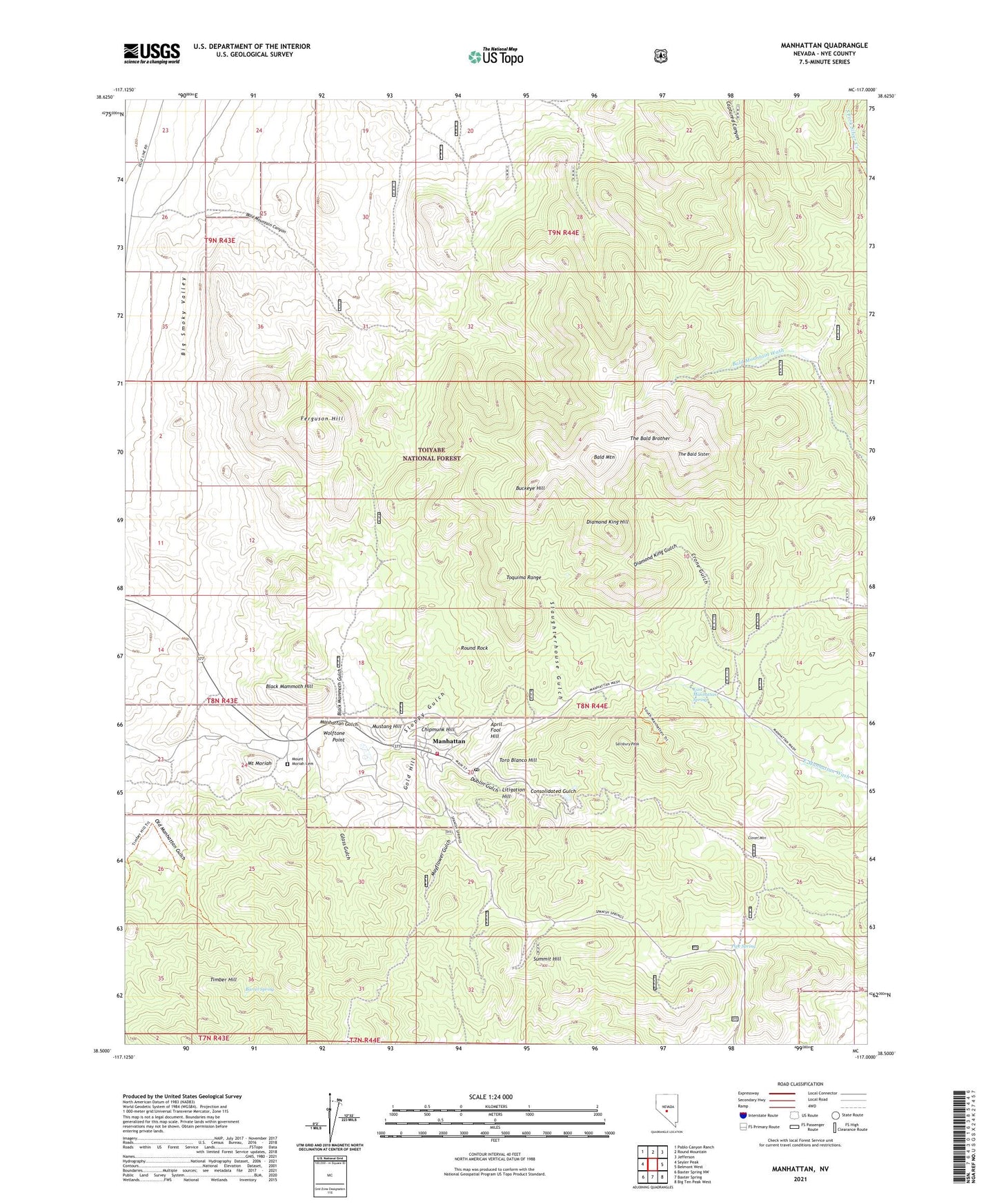
Manhattan Nevada US Topo Map
Couldn't load pickup availability
Also explore the Manhattan Forest Service Topo of this same quad for updated USFS data
2021 topographic map quadrangle Manhattan in the state of Nevada. Scale: 1:24000. Based on the newly updated USGS 7.5' US Topo map series, this map is in the following counties: Nye. The map contains contour data, water features, and other items you are used to seeing on USGS maps, but also has updated roads and other features. This is the next generation of topographic maps. Printed on high-quality waterproof paper with UV fade-resistant inks.
Quads adjacent to this one:
West: Seyler Peak
Northwest: Pablo Canyon Ranch
North: Round Mountain
Northeast: Jefferson
East: Belmont West
Southeast: Big Ten Peak West
South: Baxter Spring
Southwest: Baxter Spring NW
This map covers the same area as the classic USGS quad with code o38117e1.
Contains the following named places: April Fool Hill, Bald Mountain, Bald Mountain Canyon, Barrel Spring, Big Four Mine, Big Pine Mine, Black Mammoth Gulch, Black Mammoth Hill, Buckeye Hill, Central, Central Post Office, Chipmunk Hill, Clover Mountain, Consolidated Gulch, Crone Gulch, Diamond King Gulch, Diamond King Hill, Dublin Gulch, Earle Mine, East Manhattan, East Manhattan Spring, Ferguson Hill, Glass Gulch, Gold Hill, Hoosier Mine, Jumbo Mine, Litigation Hill, Manhattan, Manhattan Consolidated Mill, Manhattan Consolidated Mine, Manhattan Mining District, Manhattan Ore and Milling Company Mill, Manhattan Post Office, Manhattan Volunteer Fire Department, Mayflower Gulch, Mount Moriah, Mount Moriah Cemetery, Mustang Hill, Nellie Gray Mine, North Manhattan, Old Manhattan Gulch, Pipe Spring, Round Rock, Salisbury Peak, Slaughterhouse Gulch, Sloppy Gulch, Stray Dog Mine, Summit Hill, The Bald Brother, The Bald Sister, Timber Hill, Toro Blanco Hill, War Eagle Mill, White Caps, White Caps Mine, Wolftone Point, ZIP Code: 89022