MyTopo
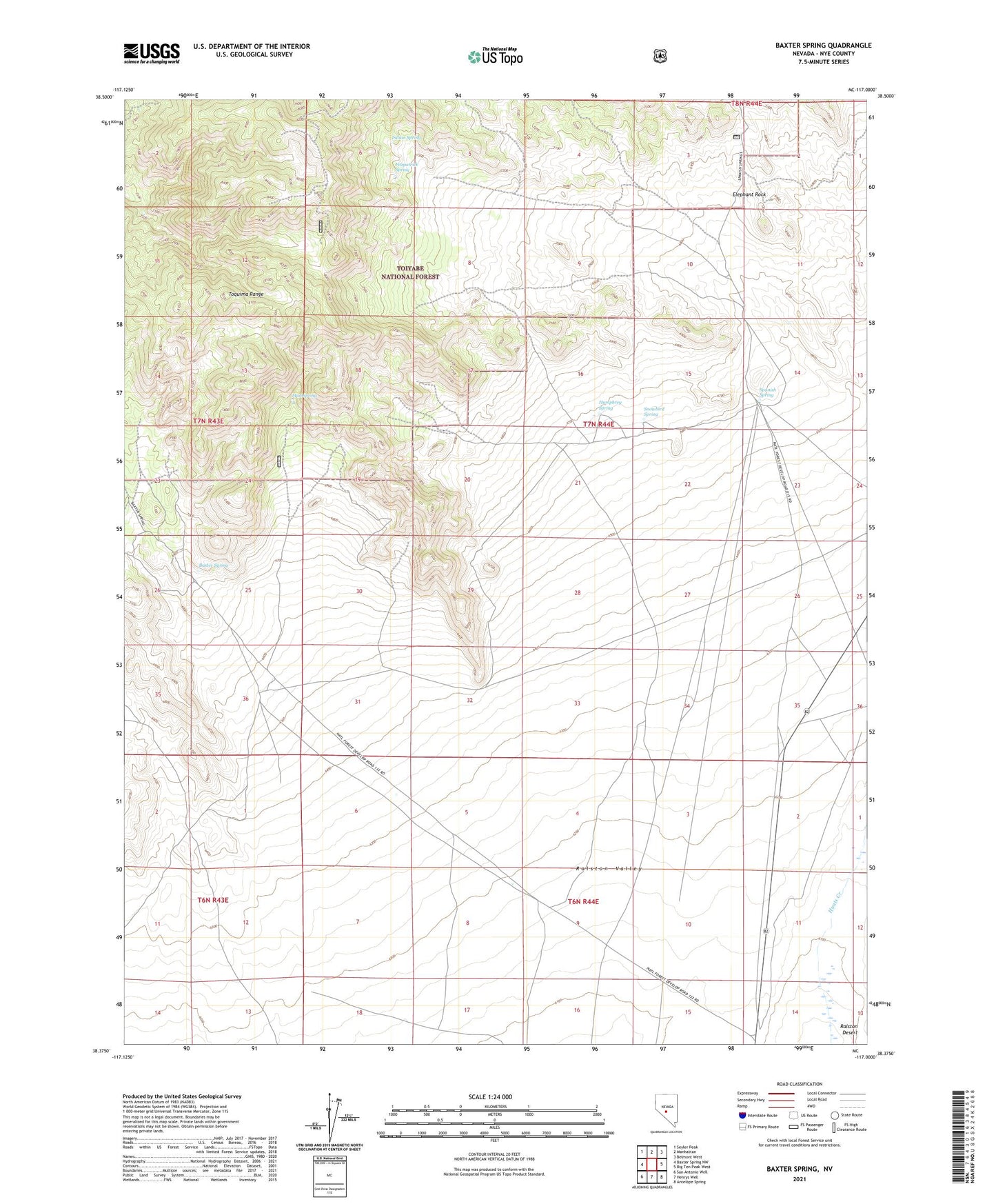
Baxter Spring Nevada US Topo Map
Couldn't load pickup availability
Also explore the Baxter Spring Forest Service Topo of this same quad for updated USFS data
2021 topographic map quadrangle Baxter Spring in the state of Nevada. Scale: 1:24000. Based on the newly updated USGS 7.5' US Topo map series, this map is in the following counties: Nye. The map contains contour data, water features, and other items you are used to seeing on USGS maps, but also has updated roads and other features. This is the next generation of topographic maps. Printed on high-quality waterproof paper with UV fade-resistant inks.
Quads adjacent to this one:
West: Baxter Spring NW
Northwest: Seyler Peak
North: Manhattan
Northeast: Belmont West
East: Big Ten Peak West
Southeast: Antelope Spring
South: Henrys Well
Southwest: San Antonio Well
This map covers the same area as the classic USGS quad with code o38117d1.
Contains the following named places: Baxter Camp, Baxter Spring, Baxter Springs, Elephant Rock, Fitzpatrick Spring, Humphrey Spring, Indian Spring, Mud Spring, Snowbird Spring, Spanish Spring