MyTopo
Blue Basin Nevada US Topo Map
Couldn't load pickup availability
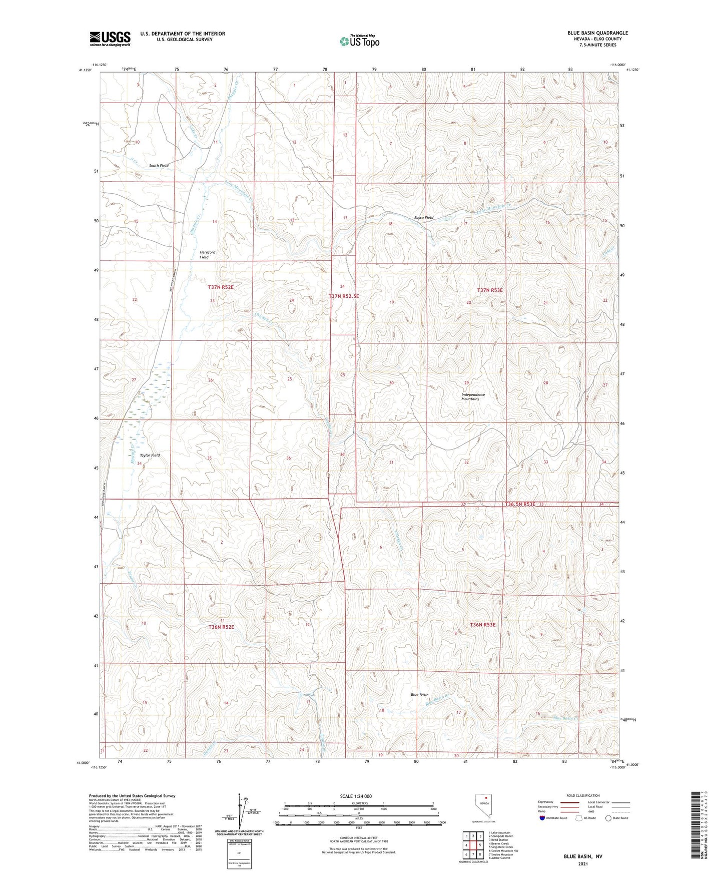
2021 topographic map quadrangle Blue Basin in the state of Nevada. Scale: 1:24000. Based on the newly updated USGS 7.5' US Topo map series, this map is in the following counties: Elko. The map contains contour data, water features, and other items you are used to seeing on USGS maps, but also has updated roads and other features. This is the next generation of topographic maps. Printed on high-quality waterproof paper with UV fade-resistant inks.
Quads adjacent to this one:
West: Beaver Creek
Northwest: Lake Mountain
North: Stampede Ranch
Northeast: Reed Station
East: Singletree Creek
Southeast: Adobe Summit
South: Swales Mountain
Southwest: Swales Mountain NW
This map covers the same area as the classic USGS quad with code o41116a1.
Contains the following named places: Basco Field, Beaver Creek, Blue Basin, Chicken Creek, Hereford Field, Lake Creek, Lone Mountain Creek, Rip Van Winkle Mine, South Creek, South Field, Taylor Creek, Taylor Field