MyTopo
Bole Spring Nevada US Topo Map
Couldn't load pickup availability
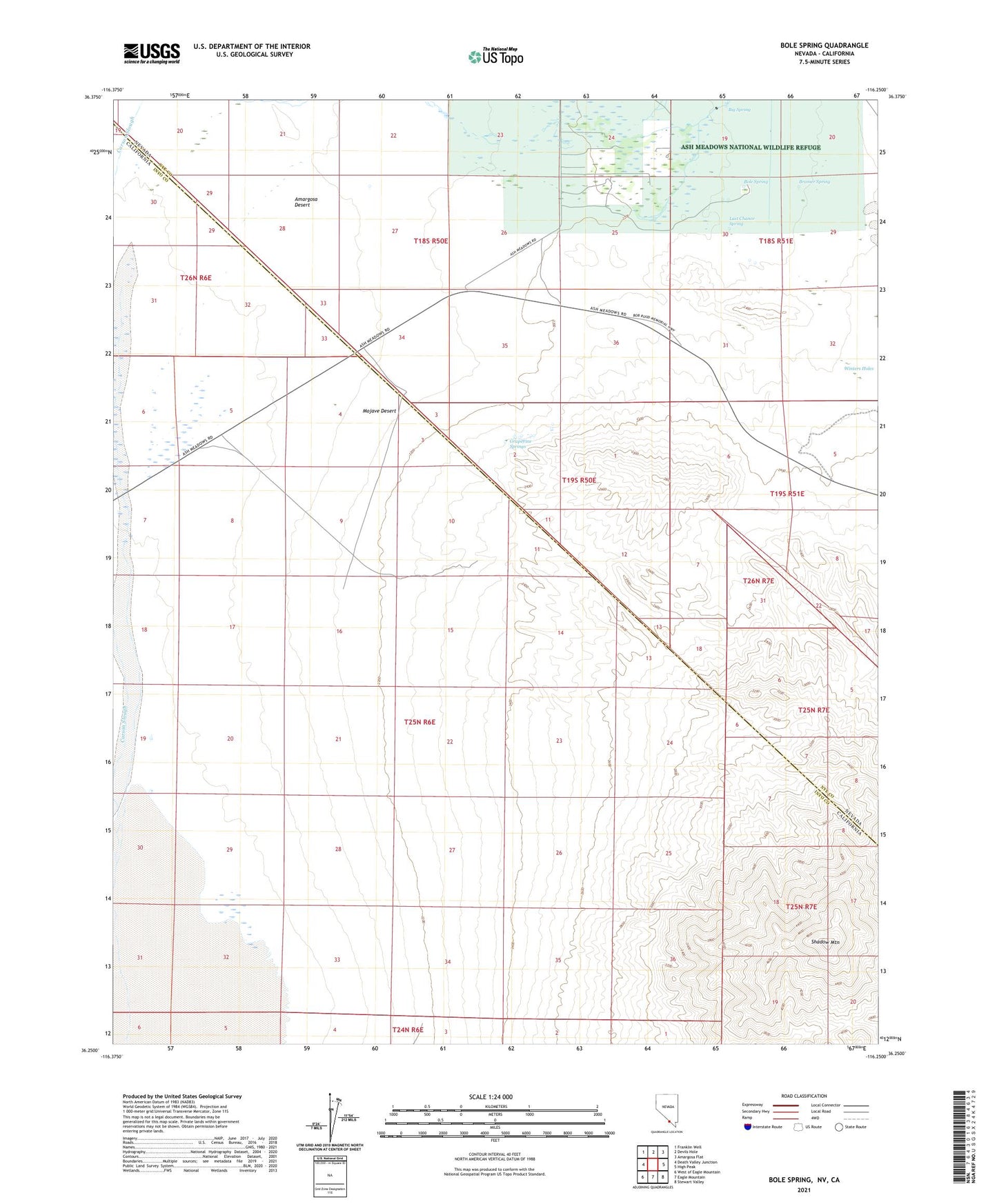
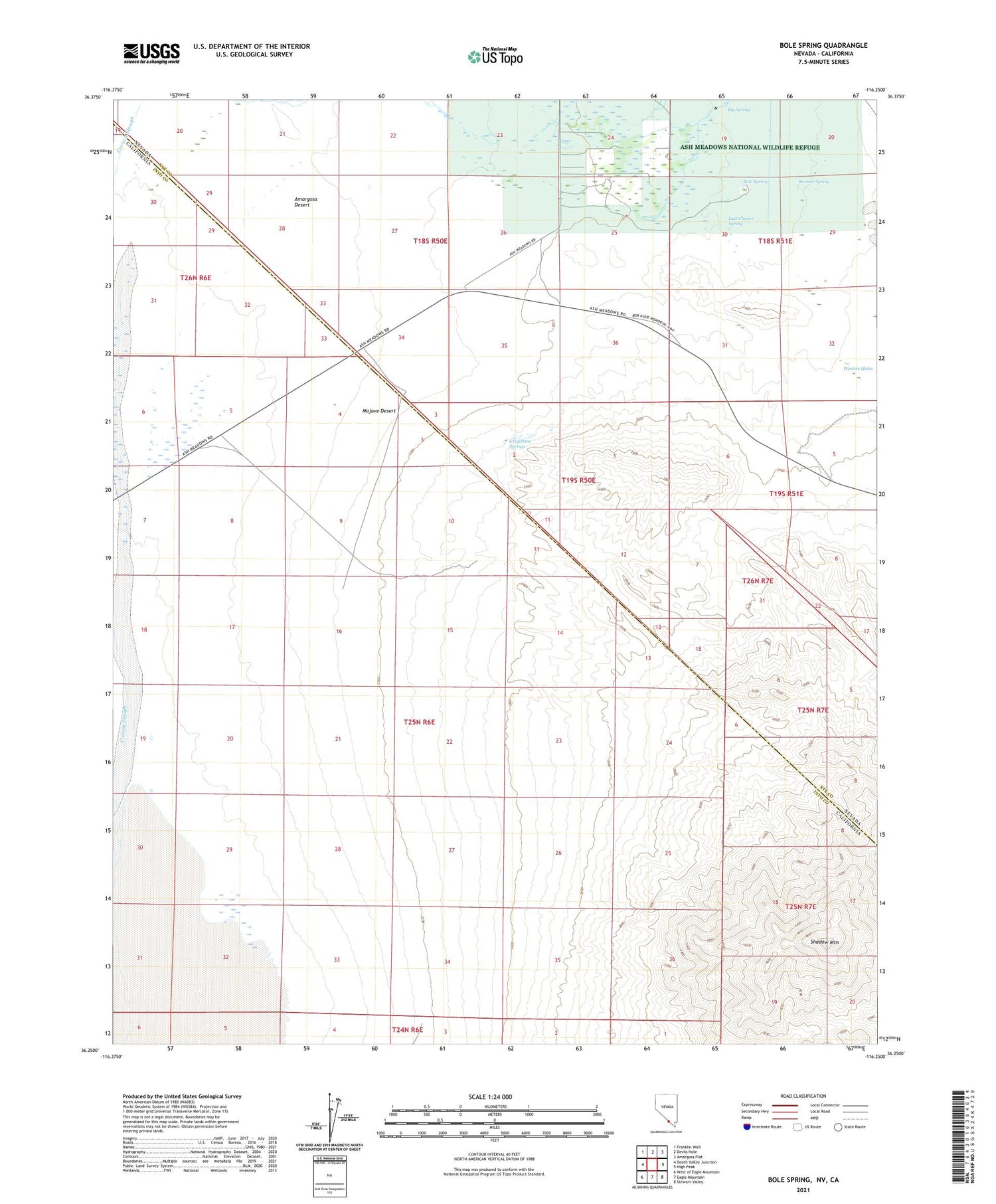
2021 topographic map quadrangle Bole Spring in the states of California, Nevada. Scale: 1:24000. Based on the newly updated USGS 7.5' US Topo map series, this map is in the following counties: Nye, Inyo. The map contains contour data, water features, and other items you are used to seeing on USGS maps, but also has updated roads and other features. This is the next generation of topographic maps. Printed on high-quality waterproof paper with UV fade-resistant inks.
Quads adjacent to this one:
West: Death Valley Junction
Northwest: Franklin Well
North: Devils Hole
Northeast: Amargosa Flat
East: High Peak
Southeast: Stewart Valley
South: Eagle Mountain
Southwest: West of Eagle Mountain
Contains the following named places: Ash Meadows Airport, Ash Meadows Rancho, Ashmeadow, Big Spring, Bole Spring, Bramer Spring, Death Valley Junction Pit, Grapevine Springs, Last Chance Spring, Shadow Mountain, Tubb Ranch, Winters Holes, Winters Ranch