MyTopo
Devils Hole Nevada US Topo Map
Couldn't load pickup availability
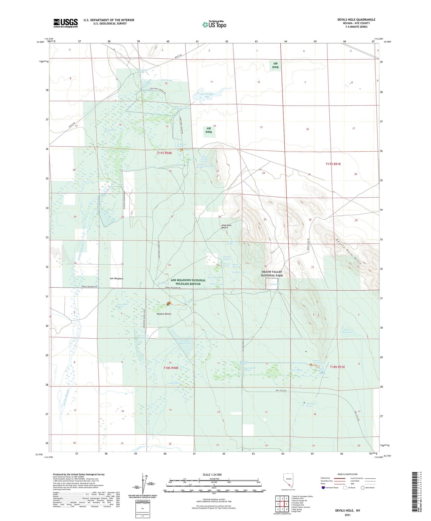
2021 topographic map quadrangle Devils Hole in the state of Nevada. Scale: 1:24000. Based on the newly updated USGS 7.5' US Topo map series, this map is in the following counties: Nye. The map contains contour data, water features, and other items you are used to seeing on USGS maps, but also has updated roads and other features. This is the next generation of topographic maps. Printed on high-quality waterproof paper with UV fade-resistant inks.
Quads adjacent to this one:
West: Franklin Well
Northwest: South of Amargosa Valley
North: Skeleton Hills
Northeast: Specter Range SW
East: Amargosa Flat
Southeast: High Peak
South: Bole Spring
Southwest: Death Valley Junction
This map covers the same area as the classic USGS quad with code o36116d3.
Contains the following named places: Ash Meadows, Ash Meadows National Wildlife Refuge, Ash Meadows National Wildlife Refuge Office, Big Spring, Bradford Springs, Button Springs, Carson Marsh, Crystal Lake Dam, Crystal Marsh, Crystal Pool, Crystal Reservoir, D H Well, Dam C, Dam C Reservoir, Davis Ranch, Davis Ranch Spring, Devils Hole, Fairbanks Ranch, Fairbanks Spring, Forest Spring, Fox Ranch, Horseshoe Marsh, Horseshoe Reservoir, Indian Garden Spring, Indian Rock Spring, Indian Spring, Jackrabbit Spring, Japanese Ranch, Lake Number One, Lake Number One Dam, Little Lake Dam, Longstreet Spring, Main Spring, Marsh Spring, Mary Scott Spring, Mexican Spring, Parent Springs, Peterson Ranch, Peterson Reservoir, Point of Rocks Springs, Purgatory Spring Well, Rogers Spring, School Spring, Skruggs Spring, Soda Spring, Tubbs Spring, Winters Ranch