MyTopo
Bridge Canyon Nevada US Topo Map
Couldn't load pickup availability
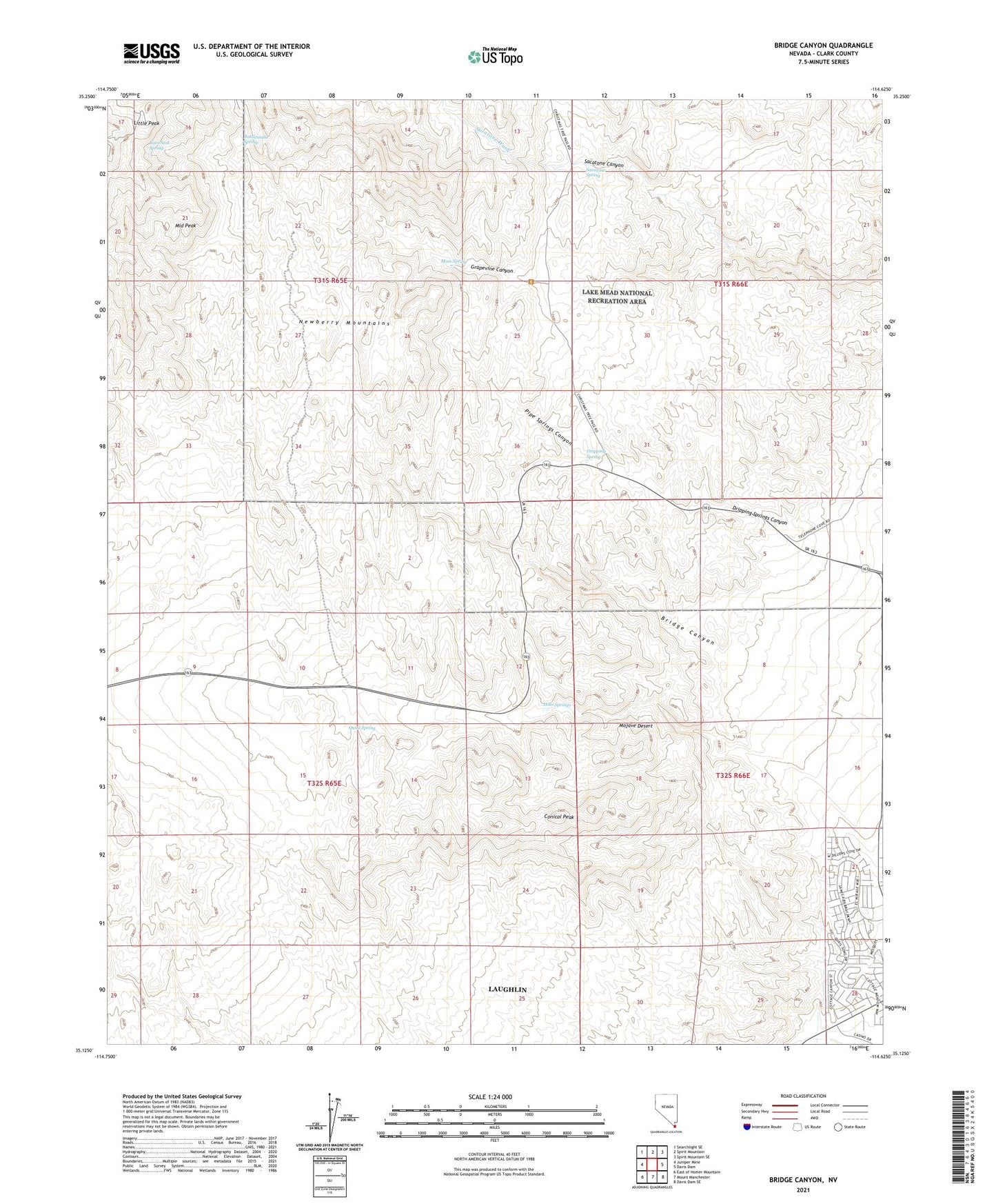
2021 topographic map quadrangle Bridge Canyon in the state of Nevada. Scale: 1:24000. Based on the newly updated USGS 7.5' US Topo map series, this map is in the following counties: Clark. The map contains contour data, water features, and other items you are used to seeing on USGS maps, but also has updated roads and other features. This is the next generation of topographic maps. Printed on high-quality waterproof paper with UV fade-resistant inks.
Quads adjacent to this one:
West: Juniper Mine
Northwest: Searchlight SE
North: Spirit Mountain
Northeast: Spirit Mountain SE
East: Davis Dam
Southeast: Davis Dam SE
South: Mount Manchester
Southwest: East of Homer Mountain
This map covers the same area as the classic USGS quad with code o35114b6.
Contains the following named places: Bridge Canyon, Bridge Canyon Wilderness, Conical Peak, Dripping Spring, Dripping Springs Canyon, Firpos Well, Hiko Springs, KROL-AM (Laughlin), Little Peak, Middle Peak, Moss Spring, Nevada Highway Patrol Southern Command Laughlin Substation, Newberry Mountains, Pipe Springs Canyon, Quail Spring, Rats Nest Spring, Rattlesnake Spring, Sacatone Canyon, Sacatone Spring, Sacatone Wash, ZIP Code: 89029