MyTopo
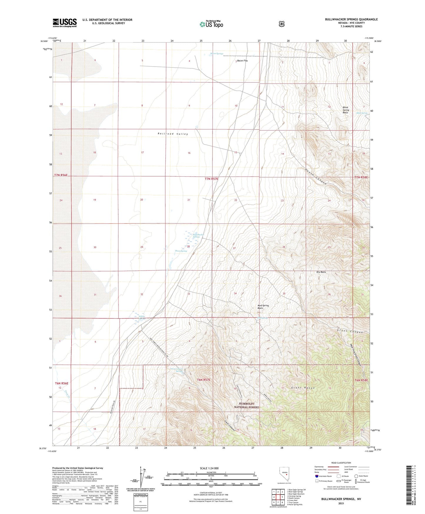
Bullwhacker Springs Nevada US Topo Map
Couldn't load pickup availability
Also explore the Bullwhacker Springs Forest Service Topo of this same quad for updated USFS data
2021 topographic map quadrangle Bullwhacker Springs in the state of Nevada. Scale: 1:24000. Based on the newly updated USGS 7.5' US Topo map series, this map is in the following counties: Nye. The map contains contour data, water features, and other items you are used to seeing on USGS maps, but also has updated roads and other features. This is the next generation of topographic maps. Printed on high-quality waterproof paper with UV fade-resistant inks.
Quads adjacent to this one:
West: Christian Spring
Northwest: Blue Eagle Springs SW
North: Blue Eagle Springs
Northeast: Blue Eagle Mountain
East: Heath Canyon
Southeast: Horse Spring Hills
South: Troy Canyon
Southwest: Crows Nest
This map covers the same area as the classic USGS quad with code o38115d5.
Contains the following named places: Bacon Flat, Bacon Springs, Blind Spring, Blind Spring Basin, Bullwhacker Springs, Dry Basin, Eagle Springs Oil Wells, Grant Canyon, Grant City, Grant Mining District, Heath Canyon, Irwin Camp, Irwin Canyon, Irwin Canyon Springs, Irwin Mine, Midland Trail, Mud Spring, Mud Spring Basin, Nye Mine, Seymour, Seymour Mining District, Terrell Mine, Thorn Spring, Troy Mining District, West Fork Grant Canyon, Willow Springs