MyTopo
Blue Eagle Springs Nevada US Topo Map
Couldn't load pickup availability
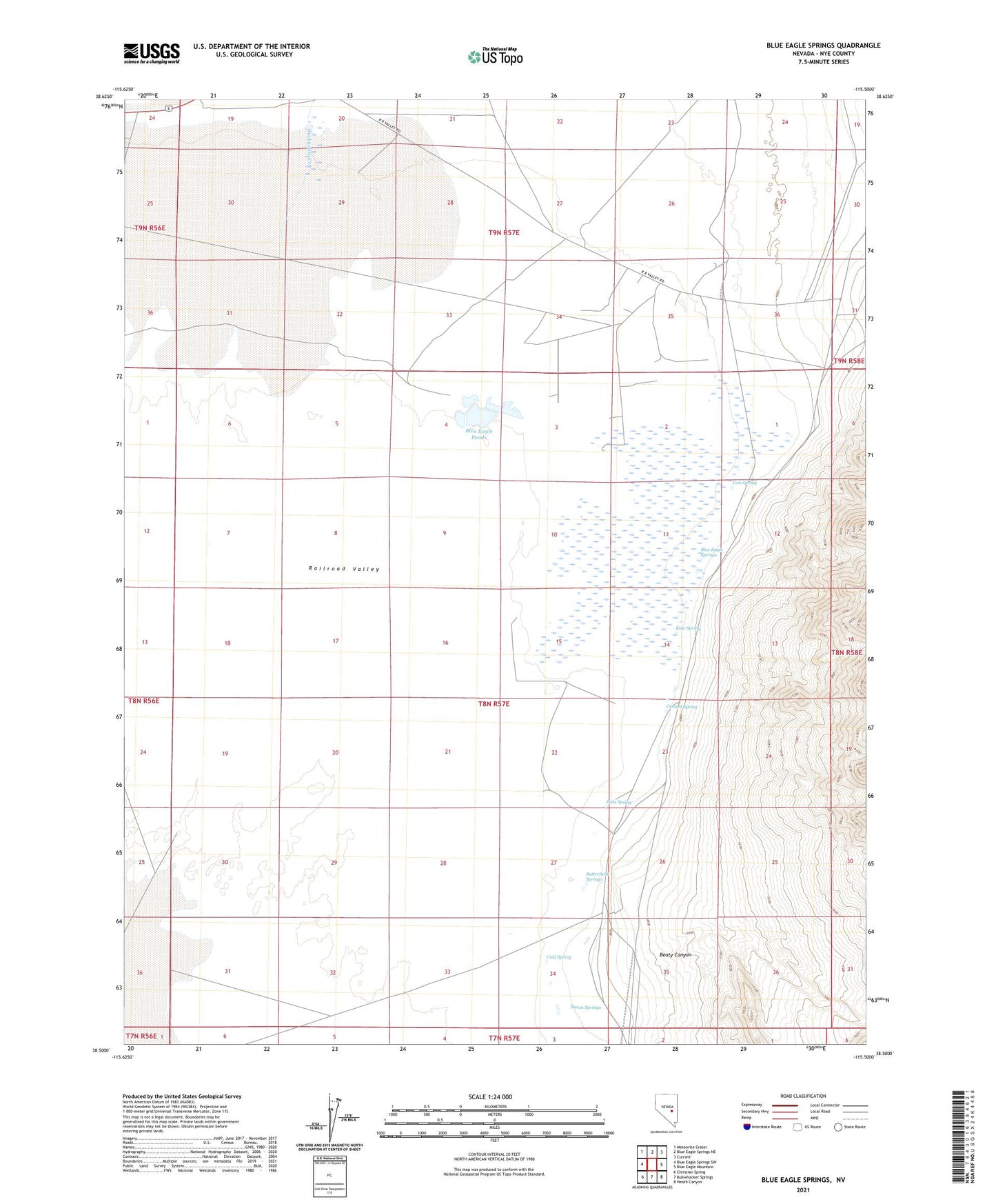
2021 topographic map quadrangle Blue Eagle Springs in the state of Nevada. Scale: 1:24000. Based on the newly updated USGS 7.5' US Topo map series, this map is in the following counties: Nye. The map contains contour data, water features, and other items you are used to seeing on USGS maps, but also has updated roads and other features. This is the next generation of topographic maps. Printed on high-quality waterproof paper with UV fade-resistant inks.
Quads adjacent to this one:
West: Blue Eagle Springs SW
Northwest: Meteorite Crater
North: Blue Eagle Springs NE
Northeast: Currant
East: Blue Eagle Mountain
Southeast: Heath Canyon
South: Bullwhacker Springs
Southwest: Christian Spring
This map covers the same area as the classic USGS quad with code o38115e5.
Contains the following named places: Bacon Springs, Beaty Canyon, Blue Eagle Ponds, Blue Eagle Ranch, Blue Eagle Spring, Blue Eagle Springs, Butterfield Springs, Carl Hanks Well, Cement Spring, Cold Spring, Duckwater Creek, Eagle Springs Oil Field, Kate Spring, Railroad Valley Wildlife Management Area, Sharp Ranch, Soda Spring, Tom Spring