MyTopo
Butte Spring Nevada US Topo Map
Couldn't load pickup availability
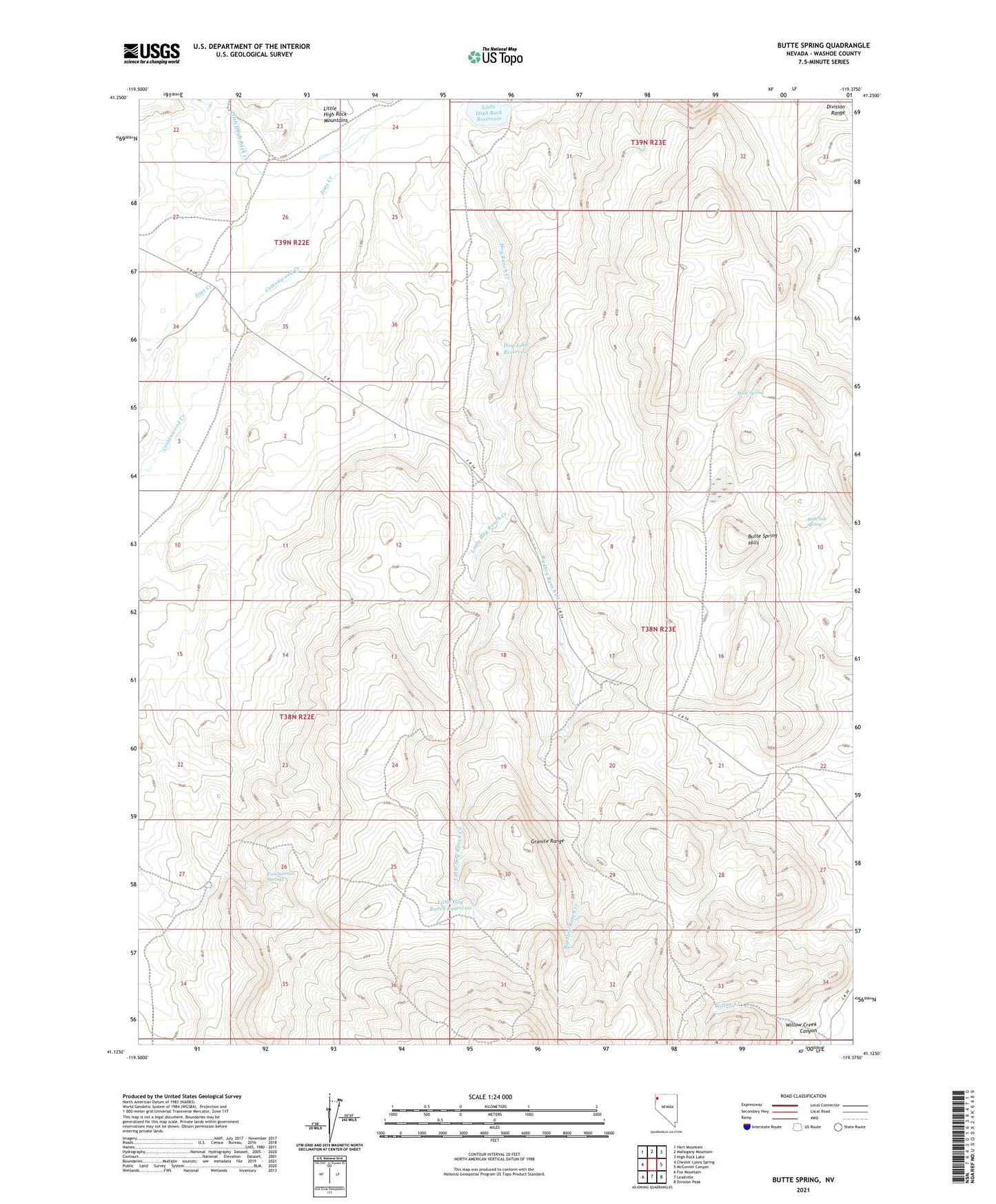
2021 topographic map quadrangle Butte Spring in the state of Nevada. Scale: 1:24000. Based on the newly updated USGS 7.5' US Topo map series, this map is in the following counties: Washoe. The map contains contour data, water features, and other items you are used to seeing on USGS maps, but also has updated roads and other features. This is the next generation of topographic maps. Printed on high-quality waterproof paper with UV fade-resistant inks.
Quads adjacent to this one:
West: Chester Lyons Spring
Northwest: Hart Mountain
North: Mahogany Mountain
Northeast: High Rock Lake
East: McConnel Canyon
Southeast: Division Peak
South: Leadville
Southwest: Fox Mountain
Contains the following named places: Bath Tub Spring, Big Hog Ranch Creek, Butte Spring, Butte Spring Hills, Cottonwood Creek, Denio Camp, Hog John Reservoir, Jims Creek, Little High Rock Canyon Wilderness, Little High Rock Dam, Little High Rock Reservoir, Little Hog Ranch Creek, Little Hog Ranch Reservoir, Swedes Place, Swingle Ranch, Van Norman Springs, Willow Creek, Willow Creek Canyon