MyTopo
Fox Mountain Nevada US Topo Map
Couldn't load pickup availability
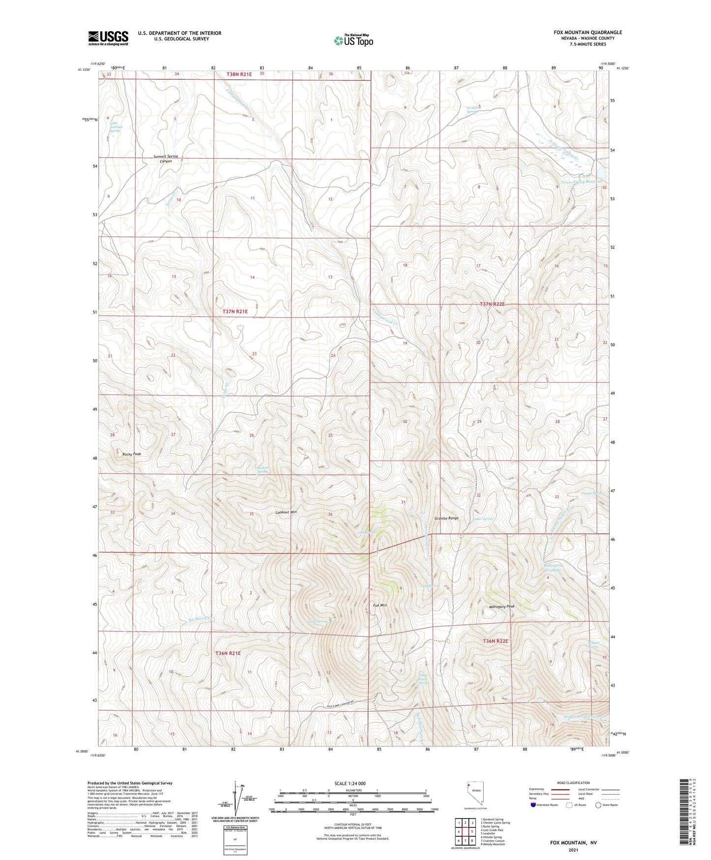
2021 topographic map quadrangle Fox Mountain in the state of Nevada. Scale: 1:24000. Based on the newly updated USGS 7.5' US Topo map series, this map is in the following counties: Washoe. The map contains contour data, water features, and other items you are used to seeing on USGS maps, but also has updated roads and other features. This is the next generation of topographic maps. Printed on high-quality waterproof paper with UV fade-resistant inks.
Quads adjacent to this one:
West: Lost Creek Pass
Northwest: Bordwell Spring
North: Chester Lyons Spring
Northeast: Butte Spring
East: Leadville
Southeast: Melody Mountain
South: Crutcher Canyon
Southwest: Hillside Spring
This map covers the same area as the classic USGS quad with code o41119a5.
Contains the following named places: Cold Spring, Corner Spring, Dollar Spring, Ferdaline Spring, Fox Mountain, Grass Valley Dam, Grass Valley Ranch, Grass Valley Reservoir, Little Antelope Spring, Little Spring, Look Spring, Lookout Mountain, Lookout Spring, Mahogany Peak, Mahogany Troughs, Potato Patch Spring, Rocky Peak, Scraper Spring, Summit Spring Canyon