MyTopo
Leadville Nevada US Topo Map
Couldn't load pickup availability
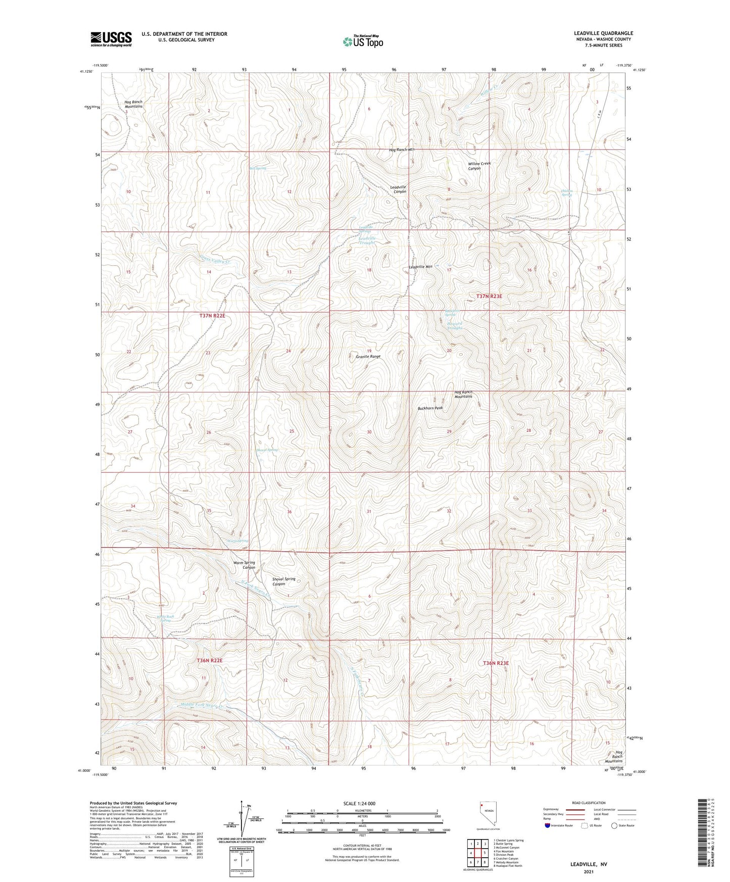
2021 topographic map quadrangle Leadville in the state of Nevada. Scale: 1:24000. Based on the newly updated USGS 7.5' US Topo map series, this map is in the following counties: Washoe. The map contains contour data, water features, and other items you are used to seeing on USGS maps, but also has updated roads and other features. This is the next generation of topographic maps. Printed on high-quality waterproof paper with UV fade-resistant inks.
Quads adjacent to this one:
West: Fox Mountain
Northwest: Chester Lyons Spring
North: Butte Spring
Northeast: McConnel Canyon
East: Division Peak
Southeast: Hualapai Flat North
South: Melody Mountain
Southwest: Crutcher Canyon
This map covers the same area as the classic USGS quad with code o41119a4.
Contains the following named places: Bell Spring, Buckhorn Peak, Buckhorn Spring, Chicken Spring, Heward Troughs, Hog Ranch Mountain, Hog Ranch Mountains, Leadville, Leadville Mine, Leadville Mining District, Leadville Mountain, Leadville Springs, Leadville Troughs, Shovel Spring, Shovel Spring Canyon, Tohoqua Mine, Warm Spring, Warm Spring Canyon, White Rock Spring