MyTopo
Calavera Canyon Nevada US Topo Map
Couldn't load pickup availability
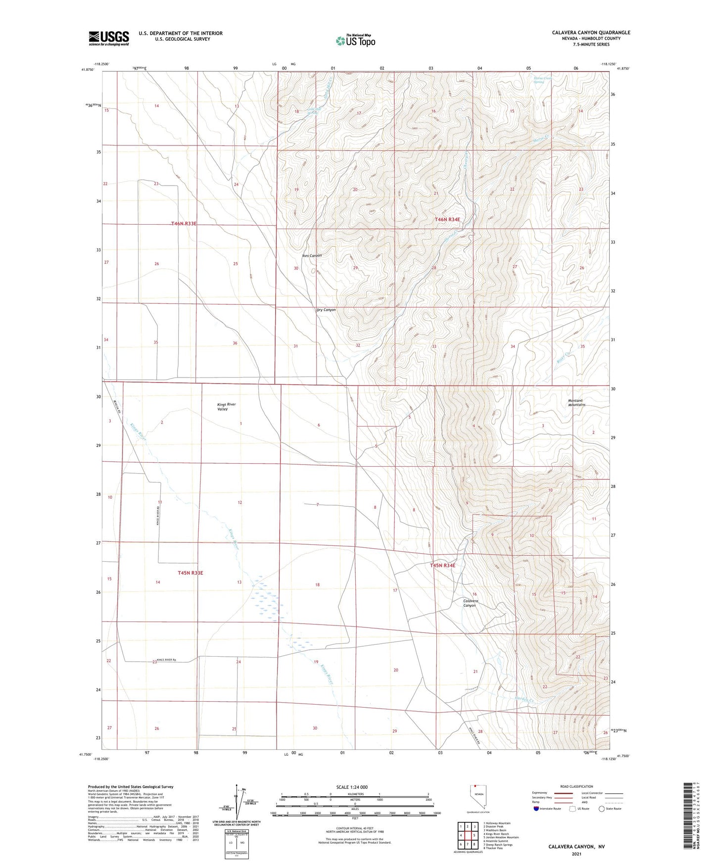
2021 topographic map quadrangle Calavera Canyon in the state of Nevada. Scale: 1:24000. Based on the newly updated USGS 7.5' US Topo map series, this map is in the following counties: Humboldt. The map contains contour data, water features, and other items you are used to seeing on USGS maps, but also has updated roads and other features. This is the next generation of topographic maps. Printed on high-quality waterproof paper with UV fade-resistant inks.
Quads adjacent to this one:
West: Kings River Ranch
Northwest: Holloway Mountain
North: Disaster Peak
Northeast: Washburn Basin
East: Jordan Meadow Mountain
Southeast: Thacker Pass
South: Sheep Ranch Springs
Southwest: Ninemile Summit
This map covers the same area as the classic USGS quad with code o41118g2.
Contains the following named places: Calavera Canyon, Cherry Creek, Dry Canyon, Fivemile Creek, Flat Creek, Garden Creek, Gold Hill Creek, Gold Hill Spring, Horse Creek, Horse Creek Spring, Ikes Canyon, Kings River Elementary School, Largasa Ranch, Moonlight Mine, Rio King Ranch