MyTopo
Kings River Ranch Nevada US Topo Map
Couldn't load pickup availability
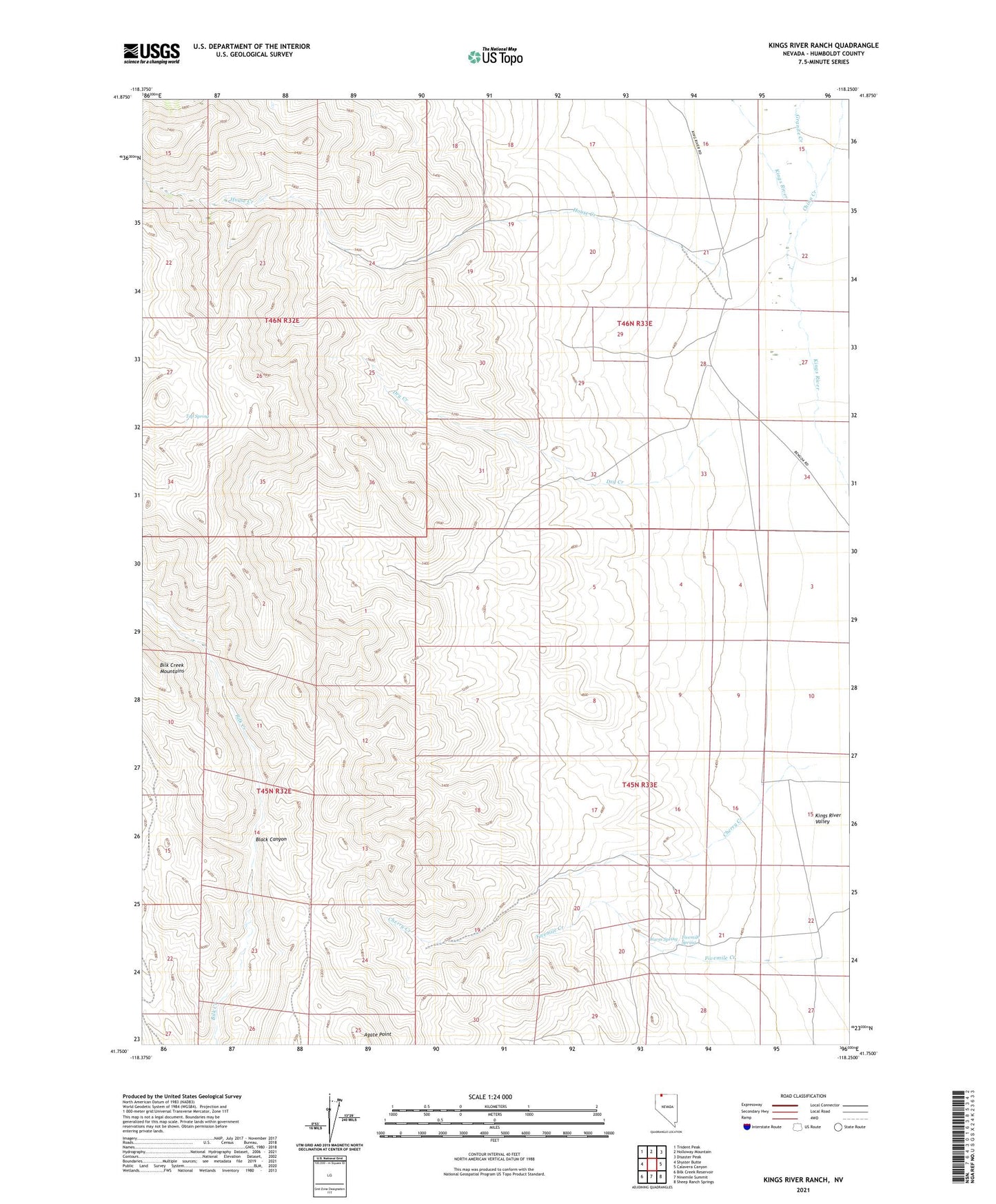
2021 topographic map quadrangle Kings River Ranch in the state of Nevada. Scale: 1:24000. Based on the newly updated USGS 7.5' US Topo map series, this map is in the following counties: Humboldt. The map contains contour data, water features, and other items you are used to seeing on USGS maps, but also has updated roads and other features. This is the next generation of topographic maps. Printed on high-quality waterproof paper with UV fade-resistant inks.
Quads adjacent to this one:
West: Shyster Butte
Northwest: Trident Peak
North: Holloway Mountain
Northeast: Disaster Peak
East: Calavera Canyon
Southeast: Sheep Ranch Springs
South: Ninemile Summit
Southwest: Bilk Creek Reservoir
This map covers the same area as the classic USGS quad with code o41118g3.
Contains the following named places: Agate Point, Black Canyon, Cherry Creek, China Creek, Dry Creek, Fivemile Spring, Granite Creek, House Creek, Kings River Ranch, Top Spring, Warm Spring