MyTopo
Campbell Creek Ranch Nevada US Topo Map
Couldn't load pickup availability
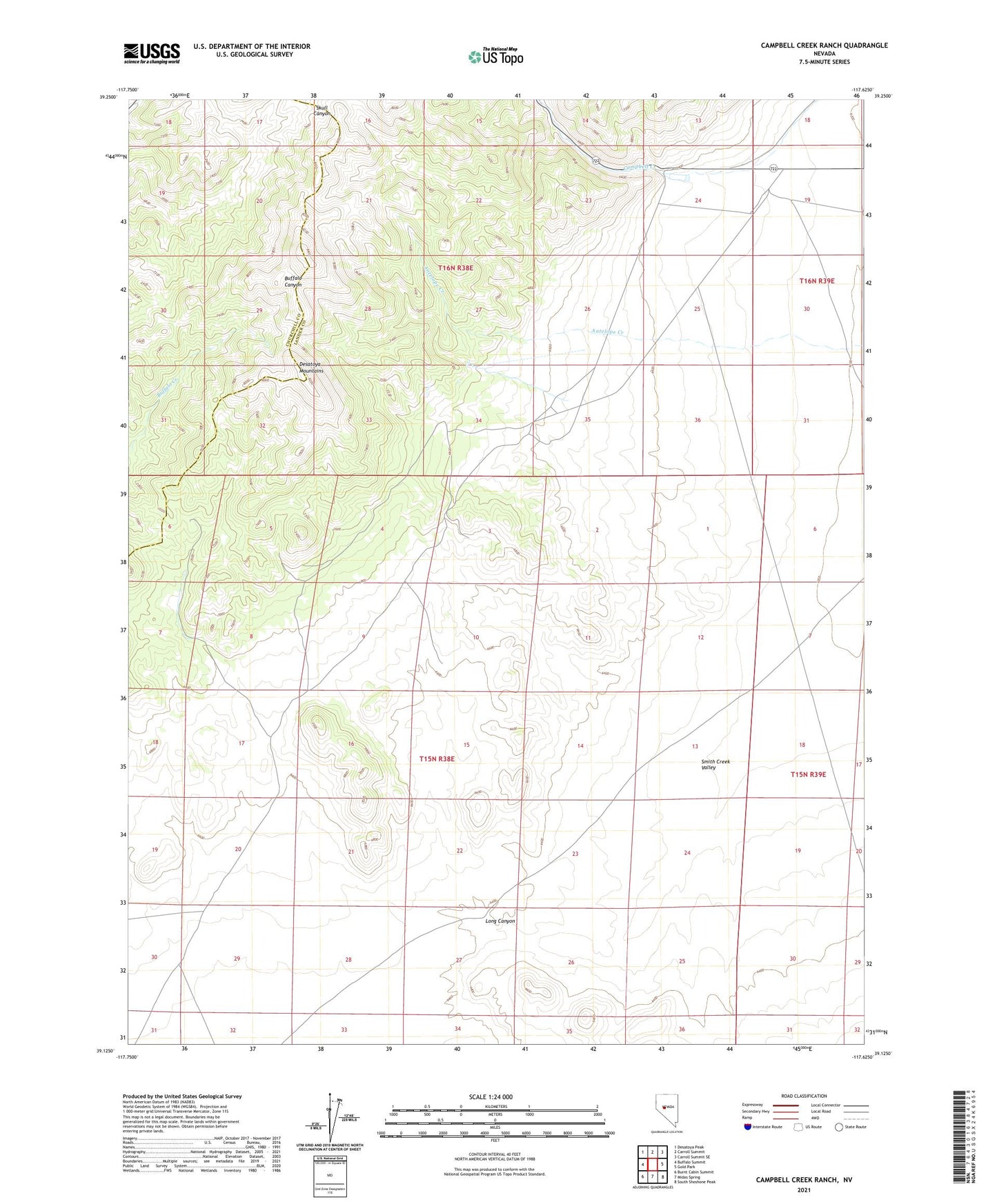
2021 topographic map quadrangle Campbell Creek Ranch in the state of Nevada. Scale: 1:24000. Based on the newly updated USGS 7.5' US Topo map series, this map is in the following counties: Lander, Churchill. The map contains contour data, water features, and other items you are used to seeing on USGS maps, but also has updated roads and other features. This is the next generation of topographic maps. Printed on high-quality waterproof paper with UV fade-resistant inks.
Quads adjacent to this one:
West: Buffalo Summit
Northwest: Desatoya Peak
North: Carroll Summit
Northeast: Carroll Summit SE
East: Gold Park
Southeast: South Shoshone Peak
South: Midas Spring
Southwest: Burnt Cabin Summit
This map covers the same area as the classic USGS quad with code o39117b6.
Contains the following named places: Aspen Mining District, Buzanes Camp, Campbell Creek Ranch, Gold Hill, Long Canyon