MyTopo
Cedar Mountain Draw Nevada US Topo Map
Couldn't load pickup availability
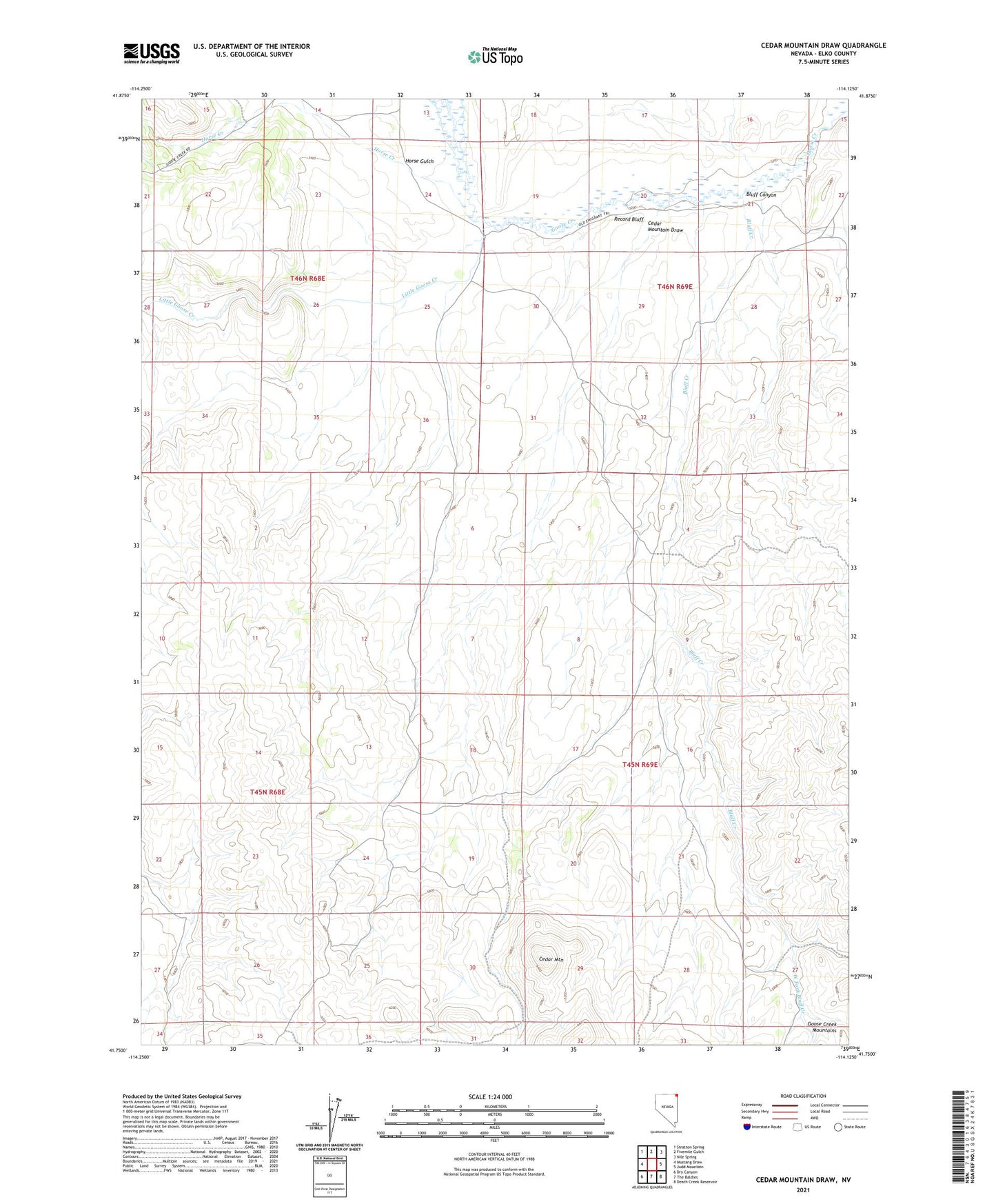
2021 topographic map quadrangle Cedar Mountain Draw in the state of Nevada. Scale: 1:24000. Based on the newly updated USGS 7.5' US Topo map series, this map is in the following counties: Elko. The map contains contour data, water features, and other items you are used to seeing on USGS maps, but also has updated roads and other features. This is the next generation of topographic maps. Printed on high-quality waterproof paper with UV fade-resistant inks.
Quads adjacent to this one:
West: Mustang Draw
Northwest: Stratton Spring
North: Fivemile Gulch
Northeast: Nile Spring
East: Judd Mountain
Southeast: Death Creek Reservoir
South: The Baldies
Southwest: Dry Canyon
This map covers the same area as the classic USGS quad with code o41114g2.
Contains the following named places: Bluff Canyon, Bluff Creek, C P Well Number 1, C P Well Number 2, Cedar Mountain, Cedar Mountain Draw, Emigrant Trail, Horse Creek, Horse Gulch, Judd Ranch, Judd Well Number 1, Judd Well Number 2, Little Goose Creek, New Well, Record Bluff, West Fork Bluff Creek