MyTopo
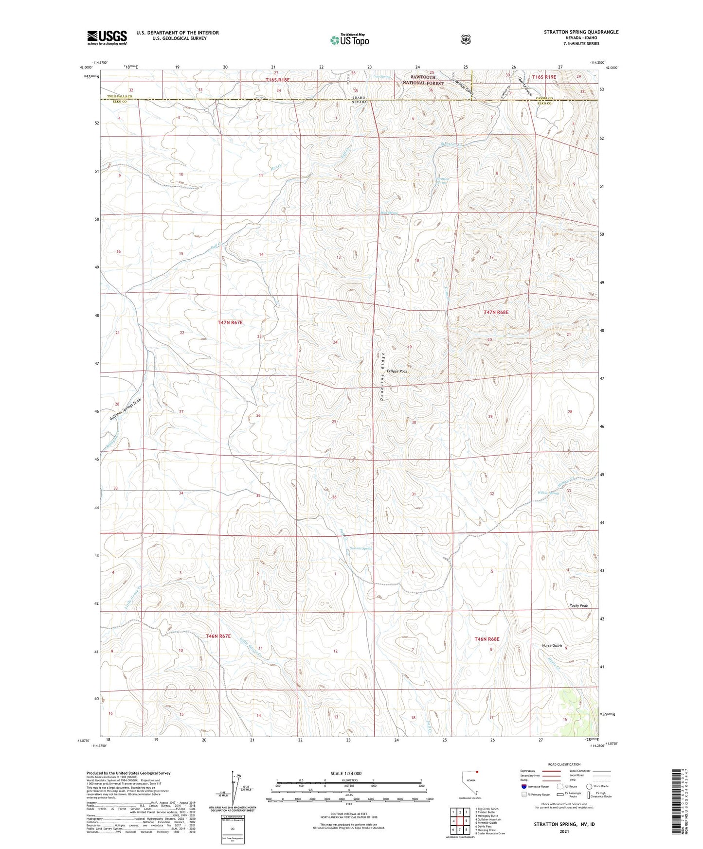
Stratton Spring Nevada US Topo Map
Couldn't load pickup availability
Also explore the Stratton Spring Forest Service Topo of this same quad for updated USFS data
2021 topographic map quadrangle Stratton Spring in the states of Idaho, Nevada. Scale: 1:24000. Based on the newly updated USGS 7.5' US Topo map series, this map is in the following counties: Elko, Twin Falls, Cassia. The map contains contour data, water features, and other items you are used to seeing on USGS maps, but also has updated roads and other features. This is the next generation of topographic maps. Printed on high-quality waterproof paper with UV fade-resistant inks.
Quads adjacent to this one:
West: Gollaher Mountain
Northwest: Big Creek Ranch
North: Timber Butte
Northeast: Mahogany Butte
East: Fivemile Gulch
Southeast: Cedar Mountain Draw
South: Mustang Draw
Southwest: Devils Pass
This map covers the same area as the classic USGS quad with code o41114h3.
Contains the following named places: Eclipse Rock, Fall Creek, Gollaher Springs Draw, Gollyer Spring Creek, Line Spring, Mud Spring, Nevada Gulch, Rocky Peak, Stratton Spring, Summit Spring, Willow Spring