MyTopo
Cloverdale Ranch Nevada US Topo Map
Couldn't load pickup availability
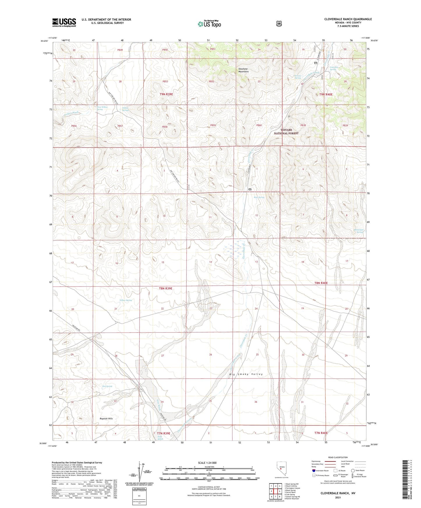
2021 topographic map quadrangle Cloverdale Ranch in the state of Nevada. Scale: 1:24000. Based on the newly updated USGS 7.5' US Topo map series, this map is in the following counties: Nye. The map contains contour data, water features, and other items you are used to seeing on USGS maps, but also has updated roads and other features. This is the next generation of topographic maps. Printed on high-quality waterproof paper with UV fade-resistant inks.
Quads adjacent to this one:
West: Black Spring
Northwest: Black Spring NW
North: Mount Ardivey
Northeast: Farrington Canyon
East: Secret Basin
Southeast: Rainier Mountain
South: Outlaw Springs NE
Southwest: Cole Spring
Contains the following named places: Cloverdale, Cloverdale Post Office, Cloverdale Ranch, Fourmile Spring, Mississippi Springs, Orizaba, Orizaba Mine, Red Spring, Republic, Rojo Spring, Stevens Spring, West Willow Spring, Willow Springs, Yellow Spring