MyTopo
Black Spring Nevada US Topo Map
Couldn't load pickup availability
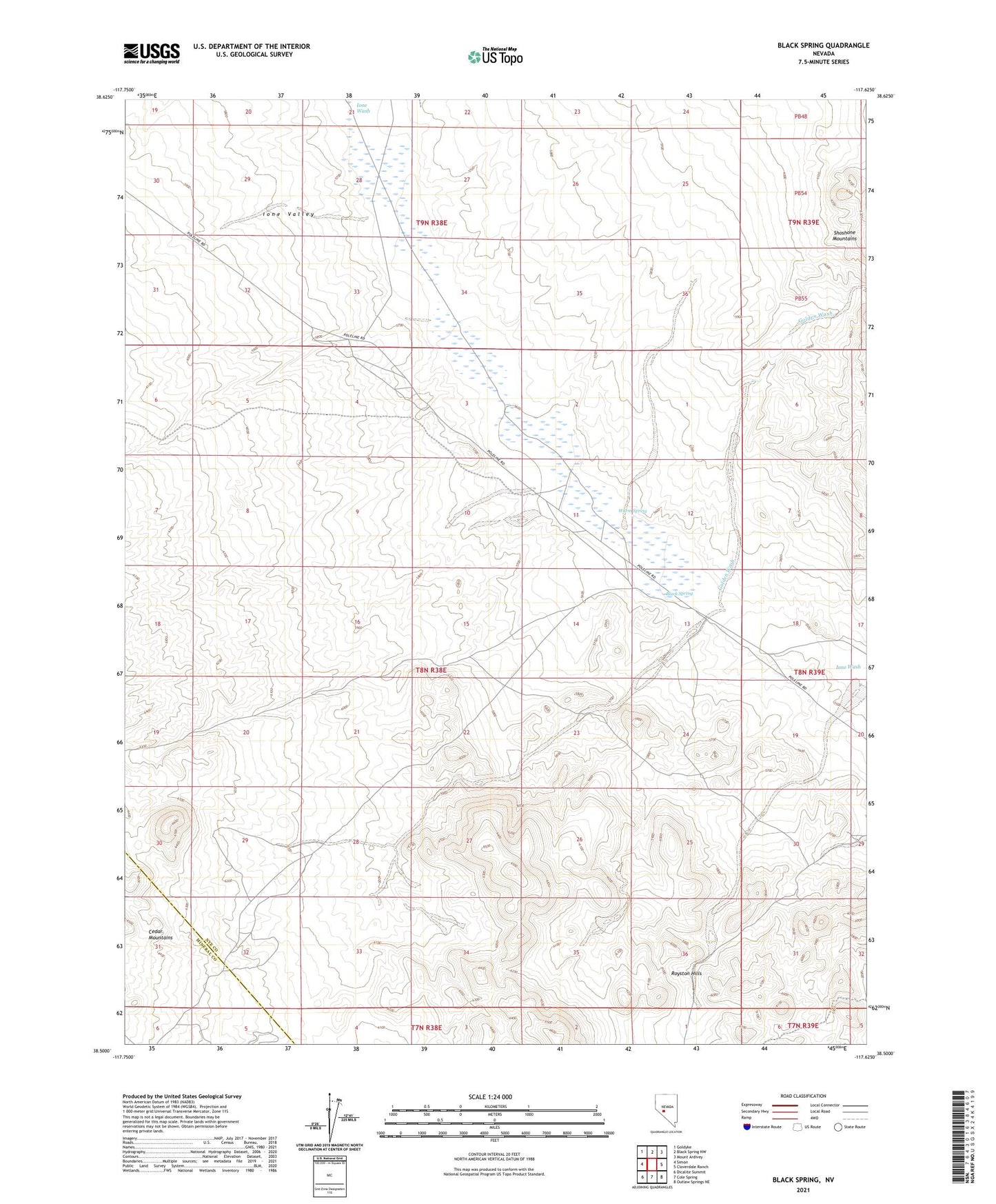
2021 topographic map quadrangle Black Spring in the state of Nevada. Scale: 1:24000. Based on the newly updated USGS 7.5' US Topo map series, this map is in the following counties: Nye, Mineral. The map contains contour data, water features, and other items you are used to seeing on USGS maps, but also has updated roads and other features. This is the next generation of topographic maps. Printed on high-quality waterproof paper with UV fade-resistant inks.
Quads adjacent to this one:
West: Simon
Northwest: Goldyke
North: Black Spring NW
Northeast: Mount Ardivey
East: Cloverdale Ranch
Southeast: Outlaw Springs NE
South: Cole Spring
Southwest: Dicalite Summit
This map covers the same area as the classic USGS quad with code o38117e6.
Contains the following named places: Black Spring, Black Spring Mining District, Cipac Mine, Golden Wash, Ione Valley, Warm Spring