MyTopo
Coal Mine Basin Nevada US Topo Map
Couldn't load pickup availability
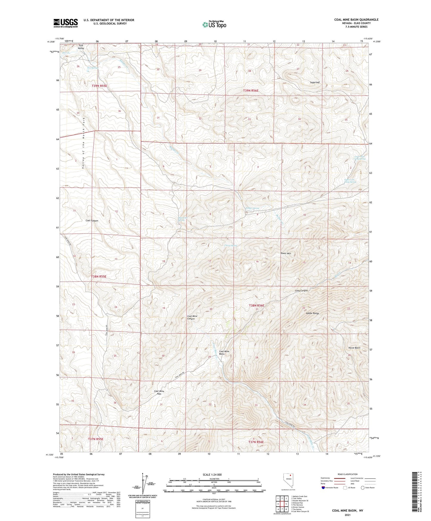
2021 topographic map quadrangle Coal Mine Basin in the state of Nevada. Scale: 1:24000. Based on the newly updated USGS 7.5' US Topo map series, this map is in the following counties: Elko. The map contains contour data, water features, and other items you are used to seeing on USGS maps, but also has updated roads and other features. This is the next generation of topographic maps. Printed on high-quality waterproof paper with UV fade-resistant inks.
Quads adjacent to this one:
West: Wieland Flat
Northwest: Mahala Creek East
North: Tule Valley
Northeast: Double Mountain SE
East: The Narrows
Southeast: Coal Mine Canyon SE
South: The Buttes
Southwest: Dinner Station
This map covers the same area as the classic USGS quad with code o41115b6.
Contains the following named places: Badger Creek, Badger Spring, Blackrock Spring, Cherry Spring, Coal Canyon, Coal Canyon Mine, Coal Mine Basin, Coal Mine Pass, Five Springs, Garamendi Mine, Lower Lost Camp Spring, Sugarloaf, Tower Mountain, Upper Lost Camp Spring