MyTopo
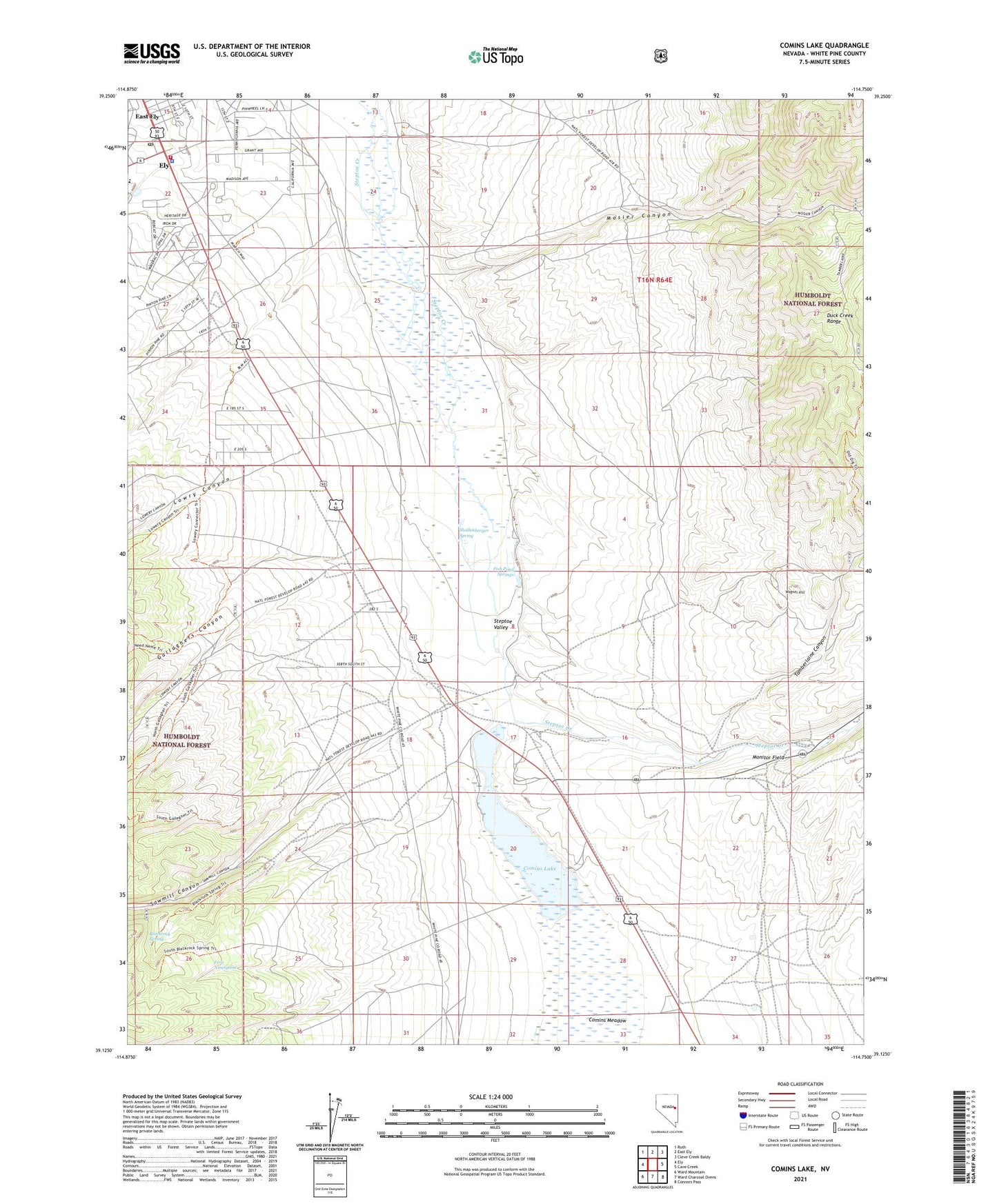
Comins Lake Nevada US Topo Map
Couldn't load pickup availability
Also explore the Comins Lake Forest Service Topo of this same quad for updated USFS data
2021 topographic map quadrangle Comins Lake in the state of Nevada. Scale: 1:24000. Based on the newly updated USGS 7.5' US Topo map series, this map is in the following counties: White Pine. The map contains contour data, water features, and other items you are used to seeing on USGS maps, but also has updated roads and other features. This is the next generation of topographic maps. Printed on high-quality waterproof paper with UV fade-resistant inks.
Quads adjacent to this one:
West: Ely
Northwest: Ruth
North: East Ely
Northeast: Cleve Creek Baldy
East: Cave Creek
Southeast: Connors Pass
South: Ward Charcoal Ovens
Southwest: Ward Mountain
This map covers the same area as the classic USGS quad with code o39114b7.
Contains the following named places: Argus Mill, Blackrock Spring, Caesar Shaft, CCC Ranch, Comins Lake, Comins Lake Dam, Comins Meadow, Ely Post Office, Ely Volunteer Fire Department, Fera Ninetynine, Fish Pond Springs, Gallaghers Canyon, Great Basin College Ely Branch Campus, Joe Shaft, John Shaft, Josephine Shaft, Lowry Canyon, McDonough Pits Mine, Monitor Field, Monitor Mill, Mosier Canyon, Sawmill Canyon, Shallenberger Spring, Steptoe Mine, Tamberlaine Canyon, Tamerlane, Vietti Shaft, Wagner Hill, White Pine County High School, White Pine County Sheriff's Office, Willow Creek