MyTopo
Ward Charcoal Ovens Nevada US Topo Map
Couldn't load pickup availability
Also explore the Ward Charcoal Ovens Forest Service Topo of this same quad for updated USFS data
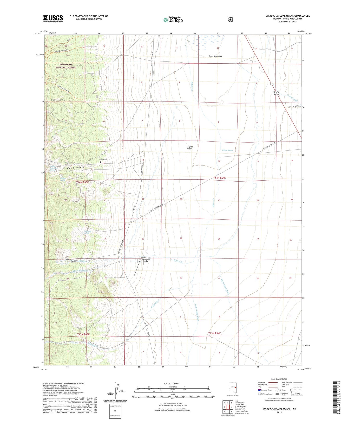
2021 topographic map quadrangle Ward Charcoal Ovens in the state of Nevada. Scale: 1:24000. Based on the newly updated USGS 7.5' US Topo map series, this map is in the following counties: White Pine. The map contains contour data, water features, and other items you are used to seeing on USGS maps, but also has updated roads and other features. This is the next generation of topographic maps. Printed on high-quality waterproof paper with UV fade-resistant inks.
Quads adjacent to this one:
West: Ward Mountain
Northwest: Ely
North: Comins Lake
Northeast: Cave Creek
East: Connors Pass
Southeast: Horse Camp Springs
South: White Rock Creek
Southwest: Sawmill Canyon
This map covers the same area as the classic USGS quad with code o39114a7.
Contains the following named places: Cattle Camp Wash, Cooper Wash, Edwards Spring, Horse Camp Wash, Millsite Spring, South Fork Willow Creek, South Steptoe Fence Well, Ward, Ward Cemetery, Ward Charcoal Ovens, Ward Charcoal Ovens State Historic Park, Ward Gulch, Ward Post Office, Williams Creek, Willow Creek Basin, Willow Creek Ranch, Willow Creek Trading Post Airport, Willow Spring, Young American Spring