MyTopo
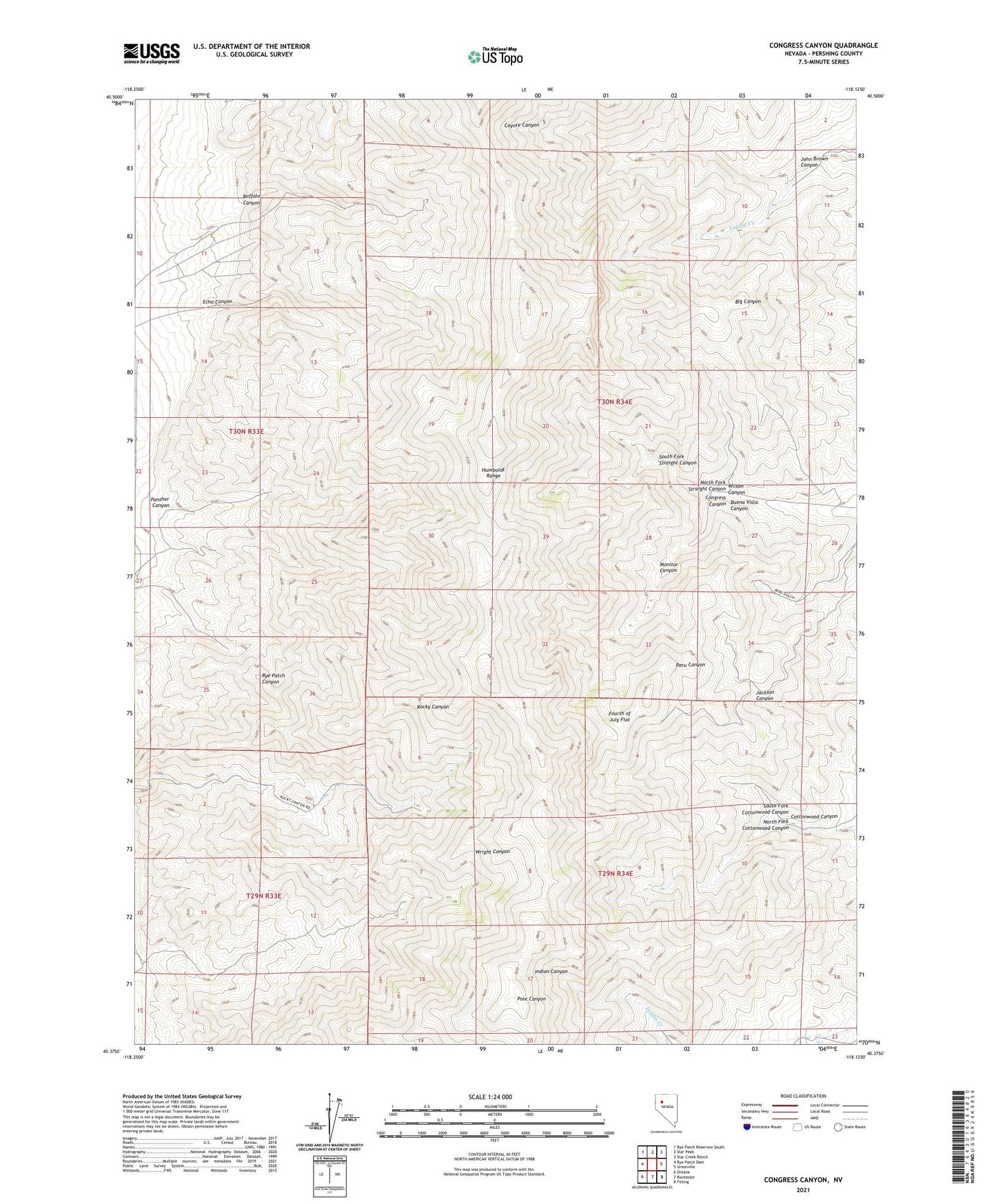
Congress Canyon Nevada US Topo Map
Couldn't load pickup availability
2021 topographic map quadrangle Congress Canyon in the state of Nevada. Scale: 1:24000. Based on the newly updated USGS 7.5' US Topo map series, this map is in the following counties: Pershing. The map contains contour data, water features, and other items you are used to seeing on USGS maps, but also has updated roads and other features. This is the next generation of topographic maps. Printed on high-quality waterproof paper with UV fade-resistant inks.
Quads adjacent to this one:
West: Rye Patch Dam
Northwest: Rye Patch Reservoir South
North: Star Peak
Northeast: Star Creek Ranch
East: Unionville
Southeast: Fitting
South: Rochester
Southwest: Oreana
Contains the following named places: Arizona Mine, Bluebird Mine, Boston Tunnel, Buena Vista Canyon Mine, Buffalo Canyon, Chipmunk Mine, Congress Canyon, Congress Canyon Mine, Congress Creek, Echo Canyon, Fourth of July Flat, Henning Mine, Humboldt Queen, Humboldt Range, Indian Mining District, Inskip Mine, John Brown Canyon, La Toska Mine, Marigold Mine, Millionaire Mine, Monitor Canyon, Moonlight Mine, North Fork Cottonwood Canyon, North Fork Straight Canyon, Panther Canyon, Panther Canyon Mine, Phlueger Mine, Rusty Pick Mine, Rye Patch Agnes Mine, Rye Patch Mine, Rye Patch Mining District, South Fork Cottonwood Canyon, South Fork Straight Canyon, Unionville Mining District, Uppertown, Wheeler Mine, Wilson Canyon