MyTopo
Rye Patch Reservoir South Nevada US Topo Map
Couldn't load pickup availability
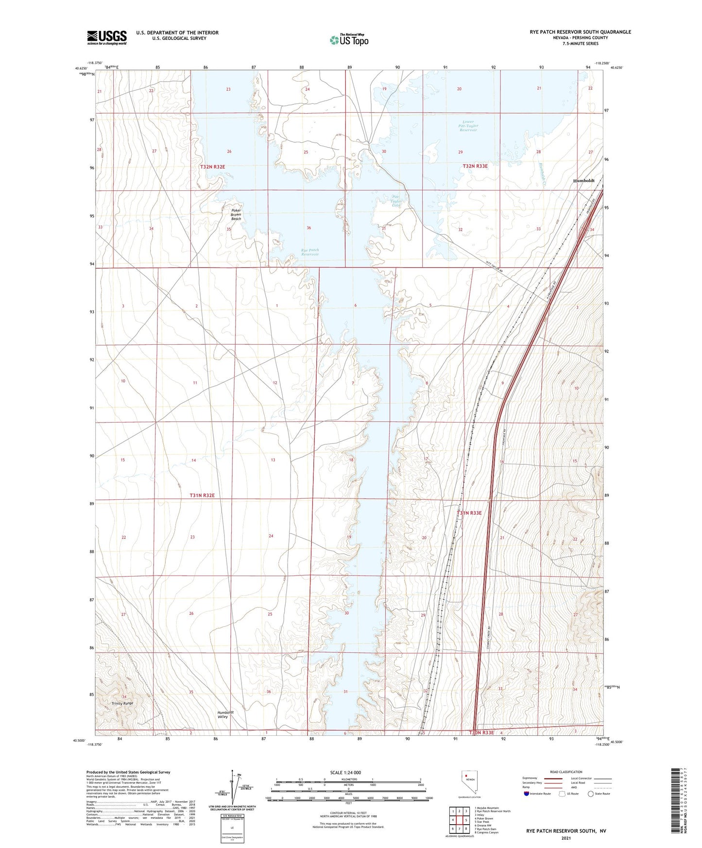
2021 topographic map quadrangle Rye Patch Reservoir South in the state of Nevada. Scale: 1:24000. Based on the newly updated USGS 7.5' US Topo map series, this map is in the following counties: Pershing. The map contains contour data, water features, and other items you are used to seeing on USGS maps, but also has updated roads and other features. This is the next generation of topographic maps. Printed on high-quality waterproof paper with UV fade-resistant inks.
Quads adjacent to this one:
West: Poker Brown
Northwest: Majuba Mountain
North: Rye Patch Reservoir North
Northeast: Imlay
East: Star Peak
Southeast: Congress Canyon
South: Rye Patch Dam
Southwest: Oreana NW
This map covers the same area as the classic USGS quad with code o40118e3.
Contains the following named places: Antelope Creek, Cavanaugh Wash, Humboldt, Humboldt Creek, Humboldt House, Humboldt Post Office, Humboldt Siding, Humboldt Valley, Imlay Division, Lower Pitt-Taylor Reservoir, Pitt-Taylor Cove, Pitt-Taylor Cove Boat Launch, Pitt-Taylor Dam, Pitt-Taylor Reservoirs, Poker Brown Beach, Poker Brown Crossing, Poker Brown Wash, Rye Patch State Recreation Area, Valery