MyTopo
Star Peak Nevada US Topo Map
Couldn't load pickup availability
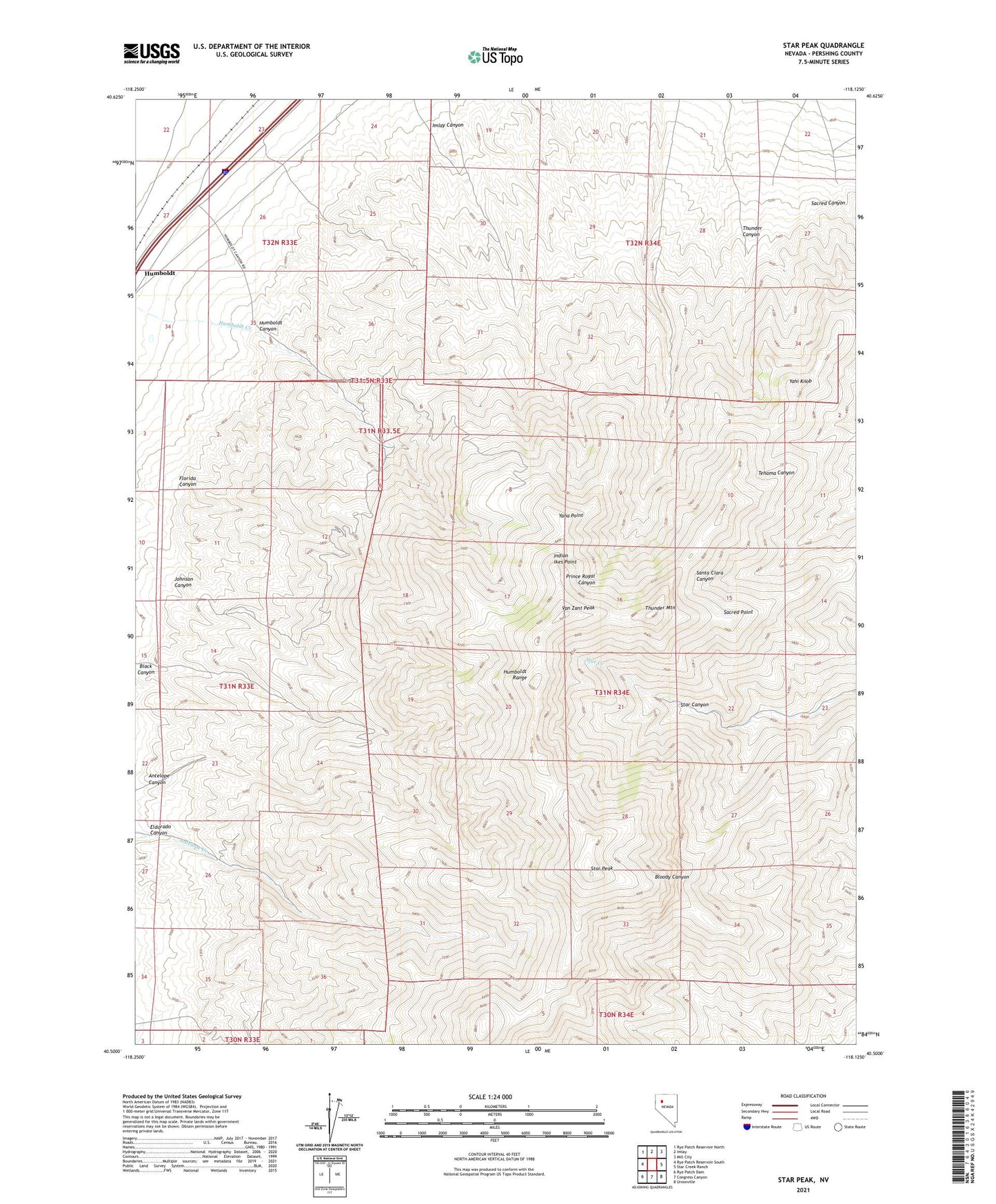
2021 topographic map quadrangle Star Peak in the state of Nevada. Scale: 1:24000. Based on the newly updated USGS 7.5' US Topo map series, this map is in the following counties: Pershing. The map contains contour data, water features, and other items you are used to seeing on USGS maps, but also has updated roads and other features. This is the next generation of topographic maps. Printed on high-quality waterproof paper with UV fade-resistant inks.
Quads adjacent to this one:
West: Rye Patch Reservoir South
Northwest: Rye Patch Reservoir North
North: Imlay
Northeast: Mill City
East: Star Creek Ranch
Southeast: Unionville
South: Congress Canyon
Southwest: Rye Patch Dam
This map covers the same area as the classic USGS quad with code o40118e2.
Contains the following named places: Antelope Canyon, Antelope Canyon Mine, Atoka, Black Canyon, Blackjack Mine, Bloody Canyon Mine, Bloody Mine, DeSoto Mine, Eldorado Canyon, Florida Canyon, Florida Canyon Mine, Fluorspar Mine, Gold King Mine, Golden Jacket Mines, Humboldt Canyon, Humboldt City, Humboldt City Post Office, Imlay Canyon, Imlay Canyon Mine, Imlay Mine, Imlay Mining District, Indian Ikes Point, Johnson Canyon, Lakeview Mine, McGee Mine, Motor Mine, Pflum Mine, Piedmont Mine, Prince Royal, Queen of Sheba Mine, Ruby, Sacred Canyon, Sacred Point, Santa Clara Mine, Silver Reef Mine, Silver Star Mine, Standard Mine, Star City, Star City Post Office, Star Mine, Star Peak, Star Peak Mine, Starlight Mine, Sulfur Mine, Thunder Canyon, Thunder Mountain, Twain, Valerie Mine, Van Zant Peak, Yahi Knob, Yana Point