MyTopo
Cortez Canyon Nevada US Topo Map
Couldn't load pickup availability
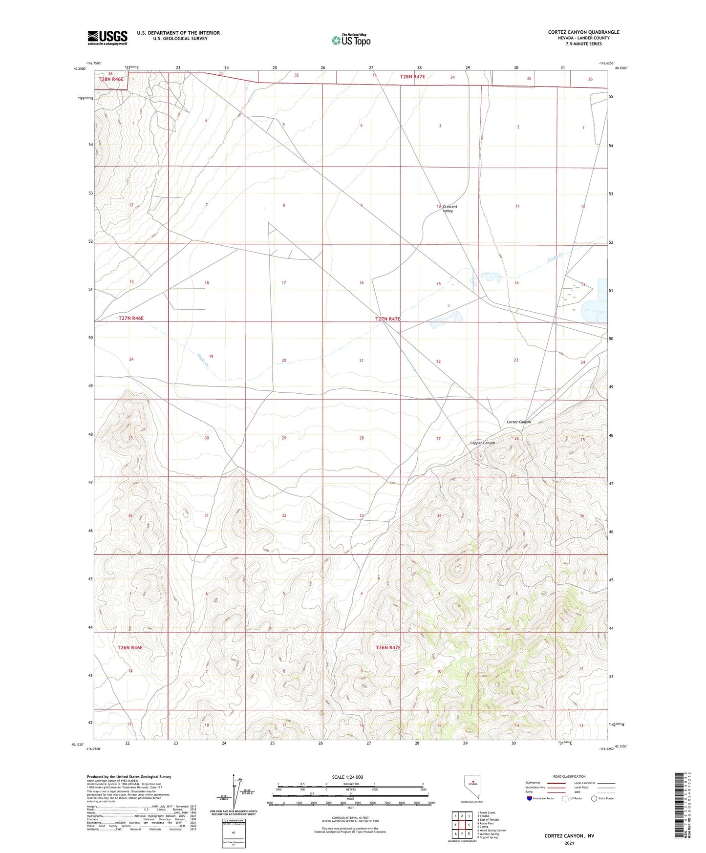
2021 topographic map quadrangle Cortez Canyon in the state of Nevada. Scale: 1:24000. Based on the newly updated USGS 7.5' US Topo map series, this map is in the following counties: Lander. The map contains contour data, water features, and other items you are used to seeing on USGS maps, but also has updated roads and other features. This is the next generation of topographic maps. Printed on high-quality waterproof paper with UV fade-resistant inks.
Quads adjacent to this one:
West: Rocky Pass
Northwest: Ferris Creek
North: Tenabo
Northeast: East of Tenabo
East: Cortez
Southeast: Dugout Spring
South: Wenban Spring
Southwest: Wood Spring Canyon
This map covers the same area as the classic USGS quad with code o40116b6.
Contains the following named places: Copper Canyon, Cortez Airstrip, Cortez Canyon, Francis Cabin, Lone Pine Mine, Rock House, Turquoise Fifty Mine, Turquoise Mine, Valley View Mine, White Horse Mine