MyTopo
Crippen Canyon Nevada US Topo Map
Couldn't load pickup availability
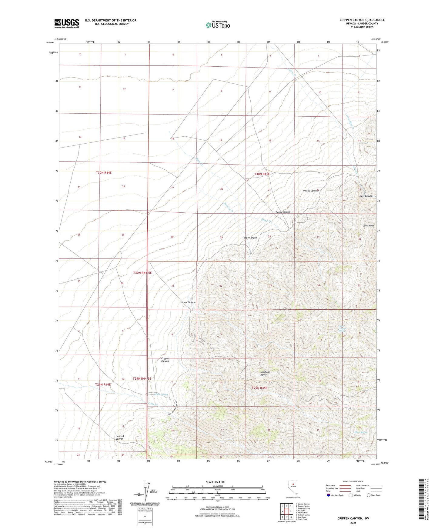
2021 topographic map quadrangle Crippen Canyon in the state of Nevada. Scale: 1:24000. Based on the newly updated USGS 7.5' US Topo map series, this map is in the following counties: Lander. The map contains contour data, water features, and other items you are used to seeing on USGS maps, but also has updated roads and other features. This is the next generation of topographic maps. Printed on high-quality waterproof paper with UV fade-resistant inks.
Quads adjacent to this one:
West: McCoy NE
Northwest: Galena Canyon
North: Blossom Spring
Northeast: Bateman Spring
East: Mount Lewis
Southeast: Ferris Creek
South: Goat Peak
Southwest: Redrock Spring
This map covers the same area as the classic USGS quad with code o40116d8.
Contains the following named places: Betty O'Neal, Betty O'Neal Mine, Betty O'Neal Post Office, Big Florence Mine, Cape Horn, Crippen Canyon, Eagle Mill, Echo Mine, Florence Mine, Frank O'Neal Mine, Friberg Mine, Gift Mine, Gold and Silver Circle Mine, Hancock Canyon, Highland Chief Mill, Hillside Mine, Home Ranch, Horse Canyon, Horse Canyon Mine, Horse Canyon Spring, Lewis, Lewis Bens Creek, Lewis Canyon, Lewis Mining District, Lewis Peak, Lewis Post Office, North Side Mine, North Wall Mine, Pipe Canyon, Roaring Creek, Rocky Canyon, Shale Spring, Sheep Creek, Starr Grove Mill, Topsy Mine, Trout Creek Ranch, Whisky Canyon, Willow Spring, Yreka Mine, ZIP Code: 89820