MyTopo
Delaware Creek Nevada US Topo Map
Couldn't load pickup availability
Also explore the Delaware Creek Forest Service Topo of this same quad for updated USFS data
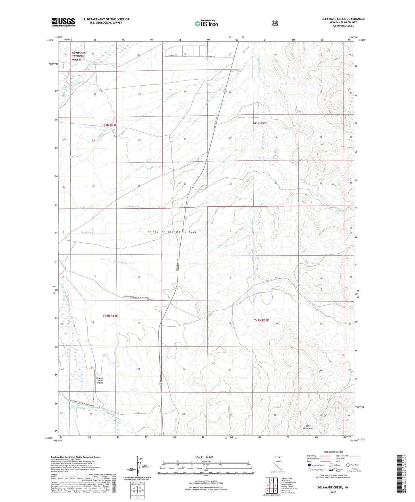
2021 topographic map quadrangle Delaware Creek in the state of Nevada. Scale: 1:24000. Based on the newly updated USGS 7.5' US Topo map series, this map is in the following counties: Elko. The map contains contour data, water features, and other items you are used to seeing on USGS maps, but also has updated roads and other features. This is the next generation of topographic maps. Printed on high-quality waterproof paper with UV fade-resistant inks.
Quads adjacent to this one:
West: McAfee Peak
Northwest: Badger Creek
North: Wild Horse
Northeast: Cornwall Mountain
East: Wagon Springs
Southeast: Double Mountain
South: North Fork
Southwest: California Mountain
This map covers the same area as the classic USGS quad with code o41115e7.
Contains the following named places: Alexander Post Office, Chicken Creek, Clear Creek, Crooked Creek, Delaware Creek, Halls, Hanks Creek, Harrison School, Jacks Creek, McAfee Creek, Stevens-Crosby Airport, Vega Ranch, Wild Horse Airport