MyTopo
Diamond Peak Nevada US Topo Map
Couldn't load pickup availability
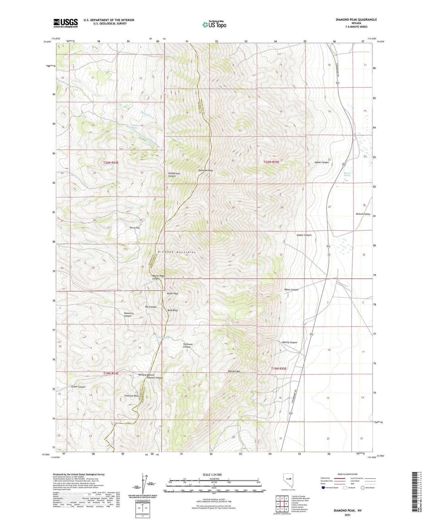
2021 topographic map quadrangle Diamond Peak in the state of Nevada. Scale: 1:24000. Based on the newly updated USGS 7.5' US Topo map series, this map is in the following counties: White Pine, Eureka. The map contains contour data, water features, and other items you are used to seeing on USGS maps, but also has updated roads and other features. This is the next generation of topographic maps. Printed on high-quality waterproof paper with UV fade-resistant inks.
Quads adjacent to this one:
West: Eureka
Northwest: North of Eureka
North: Rattlesnake Mountain
Northeast: Buck Mountain West
East: West of Beck Pass
Southeast: Pancake Summit
South: Silverado Mountain
Southwest: Pinto Summit
Contains the following named places: Adobe Canyon, Alpha Peak, Battery Mine, Bay State Mine, Bold Bluff, Circle Ranch, Cottonwood Spring, De Bernardi Ranch, Diamond Peak, Fusulina Peak, Gimmie Mine, Green Canyon, Meister Mine, Mining Canyon, Newark, Newark Mill, Newark Mining District, Newark Mountain, Newark Summit, Newark Valley School, Poison Spring, Ratto Ranch, Sadler Canyon, Stinson Spring, Torre Flat, Water Canyon