MyTopo
Silverado Mountain Nevada US Topo Map
Couldn't load pickup availability
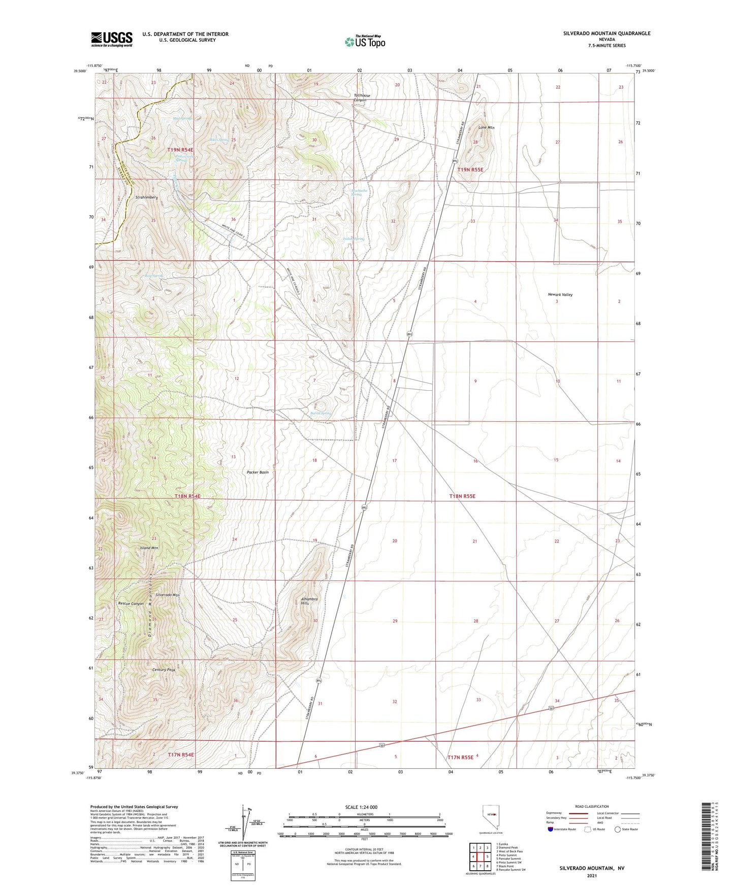
2021 topographic map quadrangle Silverado Mountain in the state of Nevada. Scale: 1:24000. Based on the newly updated USGS 7.5' US Topo map series, this map is in the following counties: White Pine, Eureka. The map contains contour data, water features, and other items you are used to seeing on USGS maps, but also has updated roads and other features. This is the next generation of topographic maps. Printed on high-quality waterproof paper with UV fade-resistant inks.
Quads adjacent to this one:
West: Pinto Summit
Northwest: Eureka
North: Diamond Peak
Northeast: West of Beck Pass
East: Pancake Summit
Southeast: Pancake Summit SW
South: Black Point
Southwest: Pinto Summit SW
This map covers the same area as the classic USGS quad with code o39115d7.
Contains the following named places: Alhambra Hills, Angelo Belli Cabin, Autumn Number Two Mine, Barrel Spring, Century Peak, Champion Mine, Cole and Johnson Mine, Duquette Mine, Fair Play Mine, Indian Spring, Island Mountain, Lagari Well, Lewis Deralls Shaft, Lone Mountain, Maryland Mine, Michigan Mine, Mikes Spring, Muchacho Spring, Mud Springs, Our Own Mine, Packer Basin, Pinto, Pinto Creek, Pinto Creek Ranch, Pinto Creek Springs, Pinto Creek Station, Pinto Mining District, Pinto Post Office, Pinto Station, Queen Mine, Rescue Mine, Rose Spring, Silver Stone Mine, Silverado Mine, Silverado Mountain, Smith Mine, Strahlenberg, Sun Burst Mine, Tollhouse Canyon, Uncle Sam Mine, Washington Mine