MyTopo
Dunphy Nevada US Topo Map
Couldn't load pickup availability
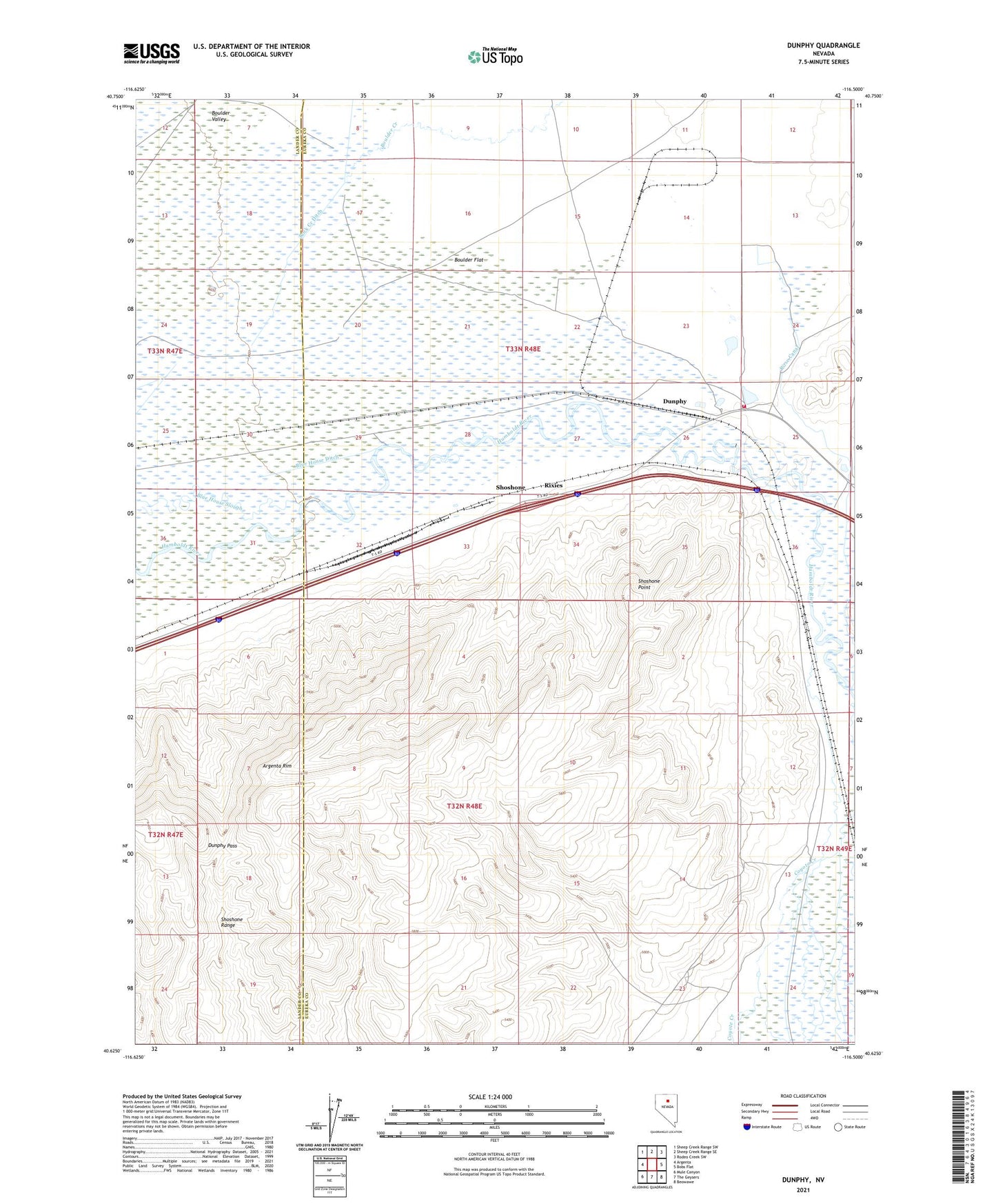
2021 topographic map quadrangle Dunphy in the state of Nevada. Scale: 1:24000. Based on the newly updated USGS 7.5' US Topo map series, this map is in the following counties: Eureka, Lander. The map contains contour data, water features, and other items you are used to seeing on USGS maps, but also has updated roads and other features. This is the next generation of topographic maps. Printed on high-quality waterproof paper with UV fade-resistant inks.
Quads adjacent to this one:
West: Argenta
Northwest: Sheep Creek Range SW
North: Sheep Creek Range SE
Northeast: Rodeo Creek SW
East: Bobs Flat
Southeast: Beowawe
South: The Geysers
Southwest: Mule Canyon
This map covers the same area as the classic USGS quad with code o40116f5.
Contains the following named places: Argenta Rim, Blue House Dam, Boulder Flat, Coyote Creek, Dunphy, Dunphy Pass, Dunphy Post Office, Dunphy Ranch, Dunphy Ranch Landing Strip, Dunphy Volunteer Fire Department, Ferrel Station, Ladoga, Old California Trail, Rixies, Rock Creek Ditch, Rose Canal, Rose Dam, Route of California Trail, Shoshone, Shoshone Point, Whitehouse Dam