MyTopo
East of Jackpot Nevada US Topo Map
Couldn't load pickup availability
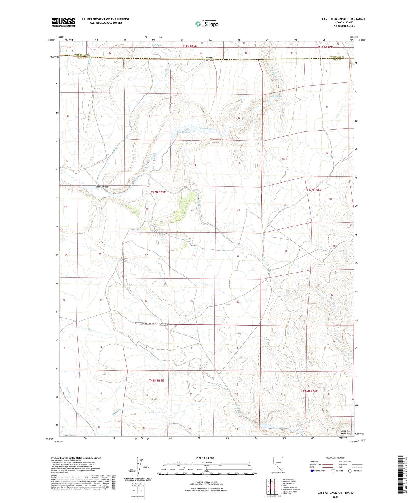
2021 topographic map quadrangle East of Jackpot in the states of Idaho, Nevada. Scale: 1:24000. Based on the newly updated USGS 7.5' US Topo map series, this map is in the following counties: Elko, Twin Falls. The map contains contour data, water features, and other items you are used to seeing on USGS maps, but also has updated roads and other features. This is the next generation of topographic maps. Printed on high-quality waterproof paper with UV fade-resistant inks.
Quads adjacent to this one:
West: Jackpot
Northwest: Norton Canyon
North: Magic Hot Springs
Northeast: Big Creek Ranch
East: Gollaher Mountain
Southeast: Devils Pass
South: Tijuana John Peak
Southwest: Middle Stack Mountain
This map covers the same area as the classic USGS quad with code o41114h5.
Contains the following named places: Bridge Ranch, Cedar Creek, Deer Springs, Hale Spring, Lost Canyon, Lost Creek, Nevada Noname Four Dam, Nevada Noname Three Dam, Warm Springs, Willow Creek