MyTopo
Gollaher Mountain Nevada US Topo Map
Couldn't load pickup availability
Also explore the Gollaher Mountain Forest Service Topo of this same quad for updated USFS data
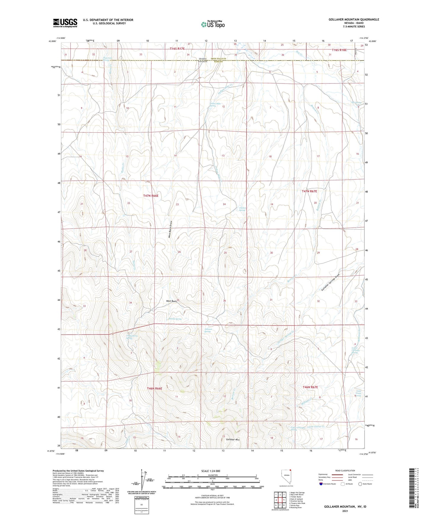
2021 topographic map quadrangle Gollaher Mountain in the states of Idaho, Nevada. Scale: 1:24000. Based on the newly updated USGS 7.5' US Topo map series, this map is in the following counties: Elko, Twin Falls. The map contains contour data, water features, and other items you are used to seeing on USGS maps, but also has updated roads and other features. This is the next generation of topographic maps. Printed on high-quality waterproof paper with UV fade-resistant inks.
Quads adjacent to this one:
West: East of Jackpot
Northwest: Magic Hot Springs
North: Big Creek Ranch
Northeast: Timber Butte
East: Stratton Spring
Southeast: Mustang Draw
South: Devils Pass
Southwest: Tijuana John Peak
This map covers the same area as the classic USGS quad with code o41114h4.
Contains the following named places: Bottom Creek, Chicken Spring, Chokecherry Spring, Gollaher Mountain, Hot Spring, Indian Mike Creek, Indian Mike Spring, Johnson Spring, Little Goose Spring, Lower Chimney Spring, Manila Spring, Milligan Creek, State Line Spring, Upper Chimney Spring, West Basin